Great Divide Mountain Bike Route 2017
In 2017, we rode the Great Divide Mountain Bike Route from Banff, Alberta to Steamboat Springs, Colorado. This page combines all our blog posts from that trip, plus a video and some other stuff.
Navigation:
Video
After the trip, we pieced together all our favorite video footage to give you a glimpse of what we saw while we were riding!
Map
The following map shows the actual route we took. The gap in the middle is where we hitchhiked to bypass the forest fires.
Blue Pins = Places We Spent the Night
To toggle between terrain and aerial view, expand the information pane and click the tile in the lower-left.
Back to top
All Blog Posts
All our posts from the trip in chronological order:7/12/17 Getting Ready
Rise and shine, DiGioia bike trip blog! After almost three years of gathering cyber dust, we are starting up our blog again to document our next big bike trip. In case you don't know, here is more about what we're doing and what's going on with us...
Since last year Jonathan and I have been preparing to ride the Great Divide Mountain Bike Route (GDMBR). Over the past few months and weeks we have been especially busy getting ready.
 |
| Jonathan installs a new set of brakes on his bike. Part of our preparation has included fixing/changing/replacing components on our bicycles over the last several weeks. |
Getting ready for this trip has been mixed with a lot of transitions and some surprises. We moved out of our apartment on Linden Avenue where we had lived for almost three years. (Unlike our strategy three years ago, we did not choose to move out of our apartment and leave on a cross-country bike trip on the same day. This time, we are spending two weeks in Lilburn with our parents before leaving for our trip.) When we moved out, we had to say good-bye (for now) to our crazy-wonderful neighbors. Several more of our dear friends have recently moved out of the state or will move away while we're gone. And when we return I'll be starting in a new position at work (same employer, different office). One of my favorite memories of getting ready will be Jonathan and me testing a new alcohol burning stove in the DiGioia's garage with the siblings-in-law Phillip and Laura. While we sat at the opening to the garage, timing how long it would take to boil a pot of water, a giant storm lit up the sky in purple, navy, and streaks of lightning.
 |
| Several friends and family members came over to help us move out of our apartment. |
 |
| Here is all of our stuff in a 10x10 storage unit! Our tandem bike (shown in the background looking sad with its flat tire) will not be coming on our trip with us, as we will be taking our two individual bikes instead. |
Where will we be, you ask? We will be following the Great Divide Mountain Bike Route (GDMBR) using maps produced by the Adventure Cycling Association. For a route overview, see the route network map on their website. Ours is the purple line through Alberta, Montana, Idaho, Wyoming, Colorado, and New Mexico. After much deliberation we decided to start our ride in Banff, Canada and ride south. We hope to make it into Colorado in the time we have. This is uncharted territory for me as I've never been "Out West."When is this trip? Our flight to Calgary leaves Sunday July 16. Lord willing, we'll be riding south from Banff beginning on July 18th and won't return to Atlanta until mid-September.
Why are we doing this? We are doing this trip for the adventure. We are doing it for quality time together. We are doing it for recreation, by which I mean the refreshment and renewal that comes with using (and strengthening) the physical bodies God gave us, taking a break from some of our daily and weekly responsibilities at home, seeing the world around us afresh, living simply for a time with only enough belongings to fit in two bike trailers, taking extra time for thought and for looking inward, and reveling in the beauty God's creation, as we experience new and diverse landscapes at about 8 miles per hour and give all due praise to God. Here's a good article from the Gospel Coalition, 5 Reasons Not to Waste Your Leisure Time, that's helped me think about the trip.
How did you get that much time off? Our employers are awesome. We have each saved up 6+ weeks of paid time off over the last three years of employment, and both of our employers are letting us take the remaining time off unpaid for a total of 8 weeks.
We will continue to update our blog as we are able with photos and blurbs about what's going on with us during our trip.
7/18/17 Take off... to the Great White North!
 |
| Yesterday we flew into Calgary via Toronto. We prayed and prayed that our bikes would all arrive in one piece. |
 |
| Thankfully, we had enlisted Carmie's help in packing them. Who knew one of her hidden talents was building custom-sized non-rectangular cardboard boxes? |
 |
| We stayed up late packing the night before. |
 |
| And finally, we were off! With the most and largest bags I have ever checked on a flight. Katelyn's dad Mike flew with us and helped us out tremendously. His favorite joke to passers-by was that we were bringing two big-screen TVs on our wilderness trip ;) |
 |
| Once we got to Calgary, we made a shopping run for food and all the dangerous stuff you can't bring on planes. |
 |
| After we finished re-assembling our bikes, we ate a celebratory dinner in the hostel cafe which included certain Canadian signature items such as poutine and Canadian beers. |
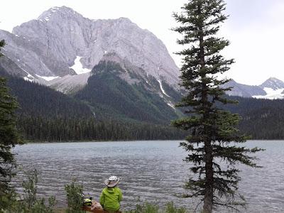
7/18/17 Banff
This morning we woke up in Banff and spent some time doing wildfire research. There are some wildfires burning in the next province over, but thankfully, none of them are currently close to our planned bike route. After learning this good news, we drove up to Lake Louise to do some hiking before we leave the area on our bikes tomorrow.
 | |||
| Mike, Katelyn, and Jonathan in front of Lake Louise |
 |
| We went on a hike from Lake Louise up to Lake Agnes |
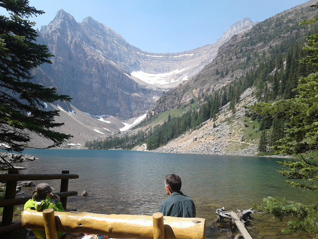 |
| We made it up to Lake Agnes (also home to a cute tea house, not pictured here), and I think we found one of the world's top lunch spots. |
 |
| There was a shuttle that took us from the Lake Louise overflow parking lot down by the highway, up and down to the lake and back. It was very convenient and well-run. |
Katelyn and I realized that, from our brief experience, we like the way the Canadians handle tourism from a public infrastructure perspective. Rather than expanding parking lots up the mountain near the lake to handle peak-season traffic--along with the accompanying environmental and economic costs--the national park just parked hundreds of people in an overflow parking lot several miles away down by the main highway and provided a free, clean, frequent, and excellently managed shuttle up and down. That meant less sitting in traffic for us, and less environmental and economic costs for Canada. We also like the town of Banff (where we're staying) because, as we experienced today, you can get dropped off in the middle of town and can walk to all the services you need. Moreover, the town was packed with people... but since those people were mostly pedestrians (remember, all those hundreds of shops, along with the banks, churches, etc. are densely situated so that everything is in walking distance), the whole town felt alive without feeling congested. This stands in contrast to many other tourist towns I've been to (I'm thinking mostly of tourist destinations in the U.S.).
After we got back to the town of Banff, we parted ways with Mike so that he could fly back to Atlanta. It was SO GREAT hanging out with him in Banff.
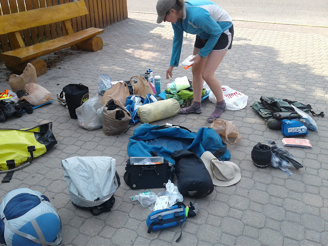 |
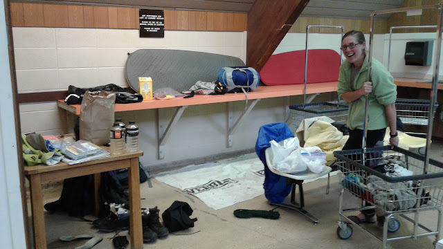
| Katelyn wades through our gear which has once again been strewn on the floor. This time it's to organize it into our various bicycle bags to prepare to bike out. |
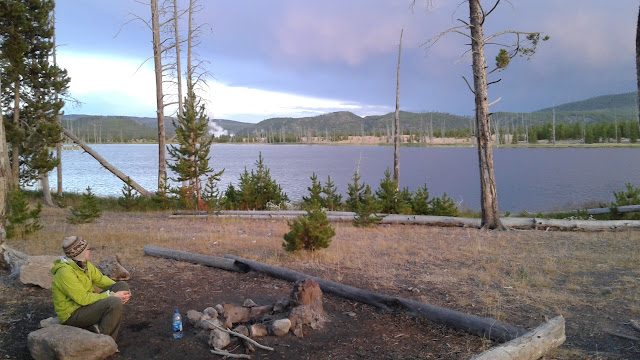
Days 1-4
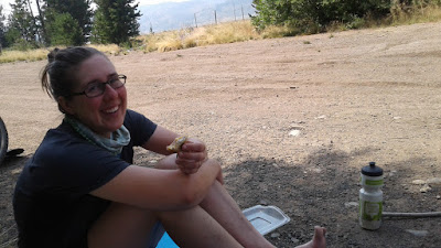
Civilization! After 4 days on the road through the woods of Alberta and British Columbia, we arrived yesterday in Elkford, BC, the first place we've had electricity, cell service, or WiFi since we set off from Banff. The warm showers at the municipal campground were wonderful :)
Things are going very well so far. Aside from a bit of drama on day 1, the trip has begun quite smoothly. Here are some highlights of our journey so far:
Day 1 (7/18/2017)
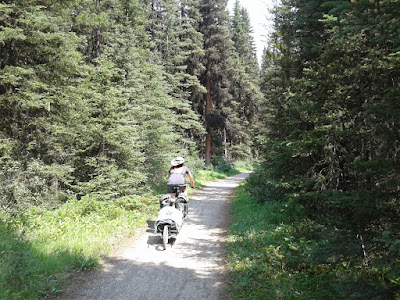
We hit the trail from Banff. So far so good.
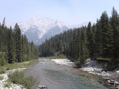
We enjoyed some beautiful scenery on the way.
We encountered several steep hills that required pushing, sometimes with difficulty.
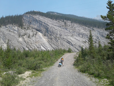
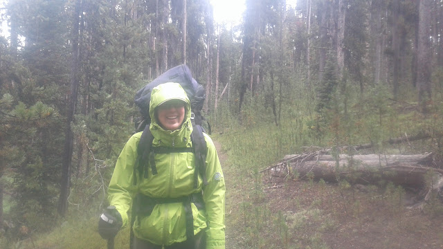
We learned the hard way how ride safely on a gravel highway. Soon after we turned off the trail onto the gravel highway, our need for speed overcame us, and we both fell when we hit a patch of loose gravel.
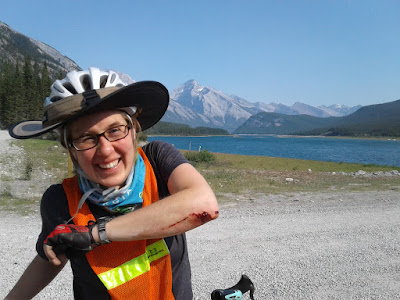
We sustained minor scrapes and bruises. However, a minor fixable issue with my bike occurred as a result of the fall. I noticed something was off but just ignored it. Bad choice. Right when we arrived at our campsite (and thank God for that timing), catastrophe struck. My rear derailleur got pulled into my spokes, which warped the derailleur hanger so badly that the bike would no longer roll. Unless something could be done about the derailleur, hanger, I would have to convert the bike to single speed and ride to the nearest bike shop then do who knows what. Derailleur hangers are not kept on hand at bike shops because they are unique to each bike.
I became very worried. What if our trip was ruined on day 1 because of my mistakes? Katelyn was less worried than me. The Lord convicted me quickly of my worry and reminded me why were here. We articulated some of these reasons in our first post. While reaching our planned destination would be great, we would not have to do that to have a successful trip. Moreover, the Lord was giving me a chance to practice trusting in him for everything. I forgot that was one of the major lessons we learned on our East Coast bike tour three years ago. It's one thing saying you trust in God for provision when you're in your element and your plans are succeeding. It feels different when so many things are unknown and outside our control. It makes us pray with a new intensity and reliance on God for provision.
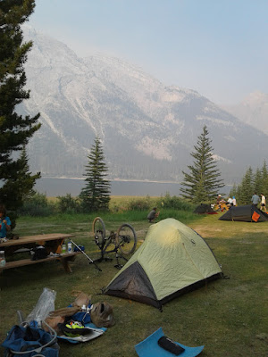
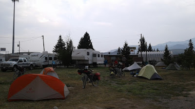
At camp, we found ourselves sharing a site with no fewer than 8 other bicycle tourists doing the same route as us: one Swiss man who passed us earlier in the day, three Australians traveling together, and a family of four Belgians on two tandem bikes.
The Lord saw fit to allow us to continue on our journey as planned, and he provided Garth the Australian man, who was not afraid to manhandle my derailleur hanger with a set of pliers, using the gap between the picnic table boards as a vice grip, and bend it back into something that resembled its original shape. The operation was risky, and some of the onlookers predicted the piece would snap, but it didn't. I now have an operational derailleur again that, while not perfect, has done its job tremendously over the last three days and counting.
Day 2 (7/19/2017)
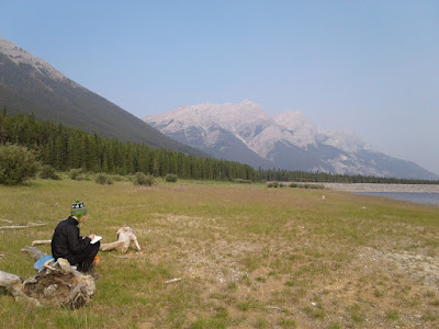
We began the day with some scripture reading, prayer, and meditation in a beautiful spot next to camp.
We took a the road alternative the main route to avoid some hills described in the guide book as "pushers." But most importantly...
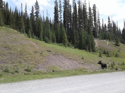
...we saw a MOOSE!!!
We also found a beautiful lunch spot by a meadow.

We camped in Peter Lougheed Provincial Park with the wonderful Belgian family we had met the night before.
We also joined the Australians (also in the same campground) in taking an "ice bath" in the frigid lake to soothe our leg muscles and wash the dust off our legs.
Day 3 (7/20/2017)
We ate breakfast at the trading post and met a family of three from Montreal (mom, dad, and 2 1/2 year old) touring on a different route that intersected ours.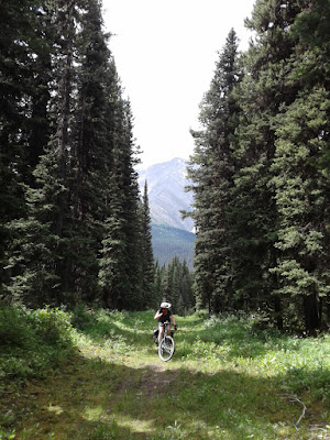
We climbed some steep hills up to Elk Pass.
We crossed the Great Divide for the first time! ...from Alberta into British Columbia.
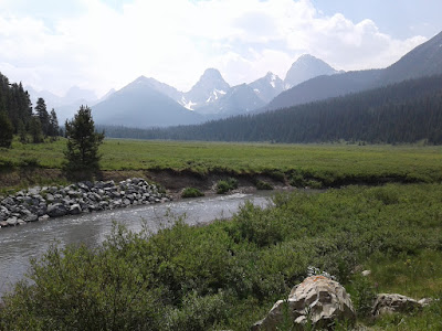
We took a detour to have lunch next to Elk Lakes. We got rained on a bit, but it wasn't bad.
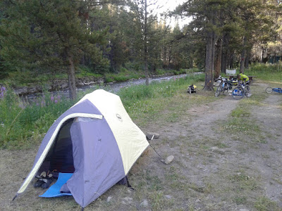
That night we camped at Weary Creek and shared a camping spot with a girl hiking northward along the Divide.
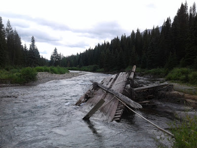
Just downstream from us was the old bridge over the creek.
At camp, we got visited by a local named Kyle, about our age, who drove up in his pickup truck and came to our campsite to talk to us and tell us about the area. He was very, very, VERY friendly. He welcomed us to the area and offered us tea, beer, and weed. We only took the tea :) He talked a lot and was the first Canadian we met who constantly used the word "Eh." I finally felt like my cultural training from Bob and Doug MacKenzie had prepared me for something! He had a beer in one hand and a lump of tabacco in his mouth the whole time we talked. After talking for a while, he drove away and we went to bed.
Day 4 (7/21/2017)
At our lunch spot today, another Divide tourist front New Zealand caught up to us. While we were talking with him, three women from Australia rode up also. They were traveling northbound, and two of the three had started at the US/Mexico border. We have been amazed at the number our other tourists we've encountered so far!
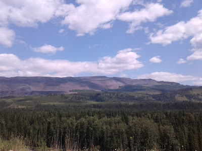
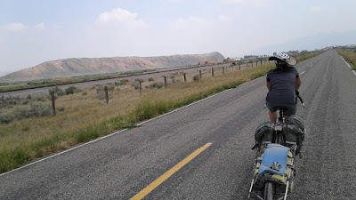
As we approached Elkford, we rode along a chain of mountains whose topography has been re-written as a result of massive coal mining operations.
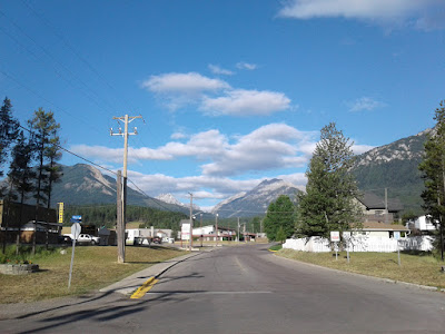
Elkford, BC is a small mining town nestled in the mountains of British Columbia.
We stayed at the municipal campground, owned by the city and operated by the Lions Club. This is where a lot of coal miners stay during the week. I struck up a conversation with several of them and learned a lot more about massive coal mining operations than I ever knew before. Also at the campground were Manuel the Swiss tourist, as well as Steve the Kiwi, a German man named Marc who has been touring the world by bike since 2011, and another southbound tourist with whom we did not talk much.

We ate at a pub that seemed popular among the miners. While we were there, got a small glimpse at small town life. We saw the two park rangers whom we had seen and talked to along the remote roads over the past two days. We saw where the pub posted the names of locals who had eaten there and not paid their tab. This was their way of discouraging such future behavior. In a similar way, the campground had notes written in the bath house about how the campground owner wanted to talk personally with whoever kept going into the showers without taking their coal mining boots of first.
The Belgian family also arrived in town and stayed in the motel across the street. They were having trouble work their water filter and one of their disc brake rotors. We had a secondary water filter that we were planning to mail back home (we still have tablets as a backup), and we have it to them. They surprised us and left is chips and a beer at our campsite :)
Today we continue south and will continue to post as we are able (and/or feel like it). We plan to cross the border into the US in about 3 days.
Days 5-8: Fernie-licious
In the past few days we've traveled from Elkford through Sparwood to Hosmer, through Fernie and Elko to Kikomun Provincial Park on Lake Koocanusa, and through the US-Canada border to Eureka, Montana. For these days, we chose to do the tamer of the two alternatives our ACA maps had to offer - known as the Fernie Alternate because it passes through the cute sporty town of Fernie, BC - but still encountered plenty of surprises, challenges, and delightful trail along the way. We also got some delicious coffee, bagels, and muffins on Fernie's main street. Mmm... But I found myself almost homesick or nostalgic for the more remote and more massive mountains of northern BC, but thoroughly enjoyed the frontcountry riding as well... and we're anticipating that the next few days in MT will be more remote again.
Day 5 (7/22/2017)

I think this was halfway up a 2+ mile climb on a mining road. Not steep just loooong!

We had heard rumors that part of the trail- here an old gravel mining road- had washed out and not been repaired. The rumors were true and we spent about 45 minutes disassembling our gear from our bikes, then individually hauling bikes, then trailers, then panniers, down to the river then up a steep climb back to the road. It was real tiring but at long last we were reassembled and onward.

Late in the day we saw this monster piece of mining equipment at the visitor center in Sparwood, a mining town and proud of it.
Day 6 (7/23/2017)

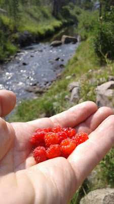
We camped and woke up in an RV park in Hosmer - a town which primarily consists of the RV park. A family from Sescatchewan let us camp on their site and use their RV bathroom as the park was woefully inequipped for tent campers. On the road the next morning Jonathan discovered Pacific Serviceberries, locally identified to us by a passing cyclist as Saskatoon berries. The berries were edible but not as good as eastern serviceberries in our opinion :) They were much less sweet than blueberries, which they resemble somewhat. Later in the day Jonathan found wild raspberries which were delicious.

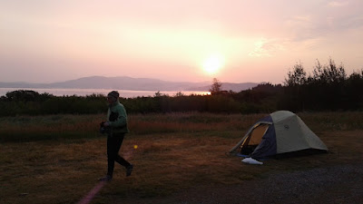
We camped that night at Kikomun Provincial Park on Koocanusa Lake in which we took a swim/bath, then enjoyed a great sunset.
Day 7 (7/24/2017)

The next morning we went down then up bizarrely steep hills at the Elk River, on our way towards the US border.

We then navigated off road through some wooded cow pasture park lands, but didn't see any cows!

After lunch by a pasture where the landscape was looking more and more like Montana and less and less like BC...

We made it to the border!

It's Montana!

We spent the night in Eureka, MT in a bed and breakfast that doesn't serve breakfast but does have BEDS! The home was built in 1908 by the man who brought electrification to Eureka. The family that owns it is from Georgia - so we got a little taste of southern hospitality here in the Big Sky state.
Day 8 (7/25/2017)
After a slow morning in Eureka we're planning to stop by the post office to mail some lesser used gear home to lighten the load then resupply on snacks and sharp cheese at the grocery store. We'll be heading south and east into Glacier National Park over the next few days.I've been reading Psalm 130 and trying to focus on God's provision for my strength. My attitude has a huge impact on my physical ability to make it along hot dusty stretches of road and to make it slowly up hills without getting off to walk. Its crazy that even in the midst of such beautiful places, in the midst of an adventure we got to choose to embark upon, I can get into such funks. Usually because of fear of the unknown and fear of things I can't control: How long is this hill going to last? Will we ever make it into some shade? Will the campground have space for us tonight?
The group Indelible Grace does a great version of Martin Luther's hymn, "From the Depths of Woe" based on Psalm 130. It makes great mental-music to ride to:
Therefore my trust is in the Lord,
And not in mine own merit;
On Him my soul shall rest, His Word
Upholds my fainting spirit;
His promised mercy is my fort,
My comfort and my sweet support;
I wait for it with patience (Wait for it with patience)
I wait for it with patience (Wait for it with patience.
We're excited for the days ahead and hope to continue to grow in physical and mental strength.

Bonus picture - community of the Tabacco Plains Indians in Canada close to the border.
Days 9-12: Polebridge and Glacier
Day 8 (continued)
After leaving our lovely bed & breakfast in Eureka, we made our way toward the national forest to begin a few days of backcountry riding.
On our way into the Kootenai National Forest, what did we encounter, but a craft brewery on the edge of the woods! We stopped and refreshed ourselves with four tiny glasses of beer at Homestead Ales Brewing before heading into the forest.

We camped at a free "dispersed" campsite in the national forest which, surprisingly, had a building next to it (we think for snowmobile use of some kind). That night we heard some very large-sounding animal walk through our campsite. Not sure what it was, but glad we used good food storage practices like we are supposed to. It didn't mess with us or our food.
Day 9 (7/26/2017)

We had some beautiful riding and gained a lot of elevation. We saw a field of bear grass, a funky flower which we are told only blooms every seven years.

We crossed the Whitefish Divide, which is not the Great Divide, but we thought it was at the time. We also met a Dutch couple touring the Great Divide but moving much faster than us. We talked about their awesome (though out of production) Schwalbe XR tires.

More beautiful riding around the Whitefish Divide.

We rode to the cool, funky town of Polebridge, MT. This town has no paved roads leading to it. You have to travel through miles and miles of national forest just to get there, but it sits on the edge of a little-used "side door" entrance to Glacier National Park.
A few of the many things that make this town interesting are that there does not appear to be any connection to an external power grid (all the buildings we were in used solar power); cell service was nowhere to be found; many of the buildings have outhouses instead of toilets; the three biggest establishments in the town are the mercantile (which sells a small selection of almost everything you need, including a gigantic assortment of delicious pastries), the cafe/saloon, and the North Fork Hostel; and even though the town is tiny, it has a library (albeit very tiny), a limited post office, and it even receives UPS deliveries despite its remoteness. The town also includes an outdoor music stage; some cabins, yurts, and private homes; lots of vegetable gardens; and a pay phone.

Some of our favorite parts were getting free huckleberry fritters simply because we arrived by bike; and the excellent hostel owner Oliver giving us a bed in his super-cool hostel, even though the hostel was "full," because he reserves beds for drop-ins who arrive on foot or by bike; and eating a delicious hot meal followed by home-made cherry rhubarb pie at the Northern Lights Saloon.

We gave our legs an "ice bath" in the North Fork Flathead River behind the hostel... and saw a beaver!
Day 10 (7/27/2017)

Before leaving Polebridge, we had breakfast outside the Mercantile and ate our free hiker/biker pastries plus got some extra for the road... mmm...

After breakfast, we rode into Glacier National Park via the Polebridge entrance and spent most of the day riding south along the Inside North Fork Road, which we had mostly all to ourselves since the middle part was closed to traffic due to a stream washout (not a bad one) and wolf habitat management. It was cool having miles and miles of this remote part of the park all to ourselves for the day. And one of the best parts...

Wild rasberries everywhere!

We filtered some stream water along the way. Stream water has been abundant along our route so far, and this is our main way of resupplying water (thanks, Good Jeff, for letting us borrow your awesome water filtration system!).

We stayed in Apgar campground with some other bicycle tourists and hikers. We love how the national parks and several other state and federal campgrounds we've gone through reserve compact shared sites for people who arrive without motor vehicles. We were able to stay in this one even though the rest of the campground was full.

We took a swim in the lake at the end of the day to wash off (the roads are very dusty). It was chilly but refreshing.
Days 11-12 (7/28-7/29/2017)
We spent a total of two nights on Glacier NP.
I biked up the Going-to-the-Sun Road to Logan Pass. Katelyn and I biked down together. Twelve miles of constant uphill in one direction and downhill in the other, with stunning views and sheer drop-offs along the way.

View from Going-to-the-Sun Road...
We did some hiking...


And one of the best parts...

More wild berries! ...including huckleberries.

Over the course of our stay in Glacier, we shared our campsite with a man from Elijay, GA here to hike, a couple from Michigan also backpacking, and bicycle tourists from Scotland, New Zealand, and Kansas City. We also saw the two Australian women who we met on our first night of the trip! Garth had already left to fly home.
We left Glacier to go back to our route and saw what we think is the first traffic signal since Banff in Hungry Horse, MT (if we remember right... the one we passed in Sparwood, BC was only a half-signal).


That night we stayed in the yard of the wonderful Arnone family whose number was listed on our maps for free cyclist accommodation. We were very thankful for their hospitality on rather short notice. Over the next days, we continued our trip through the Flathead Valley, which we will post soon.
Days 13-15: Flathead Valley, Smoke on the Water, Helena
Day 13 (7/30/2017)
We began the day at the Arnone's, and Tom showed me around his motorcycle and bike shop, which was very cool.
Tom has built his own bicycle frames, including one for a tandem bike on which he and his son won a prize in a national championship race.

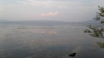
We rode to the touristy town of Bigfork, MT, which sits on the largest freshwater lake west of the Mississippi. It was HUGE!
On the way, we found...

Wild cherries! ...mmm...

We camped at Wayfarers State Park, which had excellent hiker/biker sites that included a fix-it stand. We shared our site with two other parties of bicycle tourists: an Italian man who has previously toured in Africa, Asia, and South America; and a retired couple from Vancouver. There was also a nice man who was living as a hobo (in the homo bono sense) there, staying in the campground for cheap and working as a window washer in town for the summer.

While we were there, we literally went to town, buying tons of fresh vegetables to binge on (is it still a binge if it's with vegetables?) and cooked them into a delicious dinner.
Day 14 (7/31/2017)

The next day we biked along the edge of the Mission Mountains, which included a 6-mile constant climb, followed by 6 miles of downhill. We did the first 6 in about 2 hours and the next 6 in under 30 minutes.

We camped on the edge of a forest service road next to some impressive western redcedars.
Day 15 (8/1/2017)

We got fancier with our breakfasts and switched from instant oatmeal packets every day to raw oat/grain mix with powdered milk and huckleberry jam we picked up at a jam store in Bigfork. Did we mention we like berries?
That morning, we came to a high point on our route where we had cell service. We checked on the wildfire status in the area (as we have been doing regularly to monitor the status of the many wildfires burning in western Montana) to make sure our route was still open and safe. We were already aware of a few detours we would have to take over the next few days due to fires. Talking on the phone with some of the ranger districts in the area, we learned that even on the detour routes, while safe from fires, the smoke situation was terrible in some places including Seely Lake (with an air quality rating of "hazardous" - the worst rating possible, two steps worse than "unhealthy"). There was no detour around it. We began looking for places to stay indoors that night, when it occured to us to try to find a ride to the other side of the smoky section.

We left the route and began riding on the main highway, where we pulled off at the Swann Valley Forest Service Information Office to get... information. The wonderful lady working there showed us maps, recommended places to stay, gave us dust masks, and even called the general store down the road to see if they had any delivery trucks heading south toward Helena that might could give us a ride. There were not any, but she have us a sheet of poster board and markers to make the best hitchhiking sign we could think of...

"NEED RIDE TO HELENA"
We put the sign on one bike trailer and headed down the road where we soon found the Swann Valley Centre general store. We talked to a few nice people between the forest service office and the store, but nobody who could give us a ride. It was looking more like we would need to find a place to stay in the area then see what happened next.
We stopped at the general store for lunch and parked the bikes in a way that displayed our sign near the door. Over lunch, it occurred to us to pray for a ride to Helena. Minutes later, we met a man on his way home to Helena with his two small dogs and one large pottery kiln who offered us a ride in his truck.

We took it! The man's name was Rick, a Vietnam veteran married with grown children who is semi-retired but still does pottery and carpentry for work.

Driving on the highway was an adrenaline rush at first, seeing the world go by at 70 mph instead of the 10-15 mph we have gotten used to. During our roughly 100-mile trip, we got to know each other a bit more, and Rick offered us a place to stay that night in a spare bedroom in his house
We took it! We helped Rick unload his pottery kiln, took him out to pizza in Helena, got a brief driving tour of Helena (and learned about Montana's surprising political and cultural similarities to the state of Georgia, which has an interesting history behind it), watched an episode of the British Father Brown TV series (based on G.K. Chesterton short stories), and enjoyed each other's company.

The next morning, we thanked our wonderful host and headed out to eat breakfast and run errands in downtown Helena. The pastries at Park Avenue Bakery were delicious. After a good morning (and early afternoon) downtown, we are heading out for a shorter day of riding out of Helena toward Lava Mountain (where, thankfully, there are no more fires in sight).
Days 16-17: Lava Mountain

Day 16 (8/2/2017)
We made the most of our day in Helena by staying at the Park Avenue bakery for quite some time and using it as home base for running several errands in town and doing things on the internet (such as paying bills, blogging) before we left. In fact, we stayed there so long that by the time we left, we had already eaten two of the days meals there, and the street out front had been re-paved while we were inside.While in town, Katelyn met two other southbound bicycle tourists from England who had arrived through the smoke. After hearing about their experience, we were glad we got a ride through it.

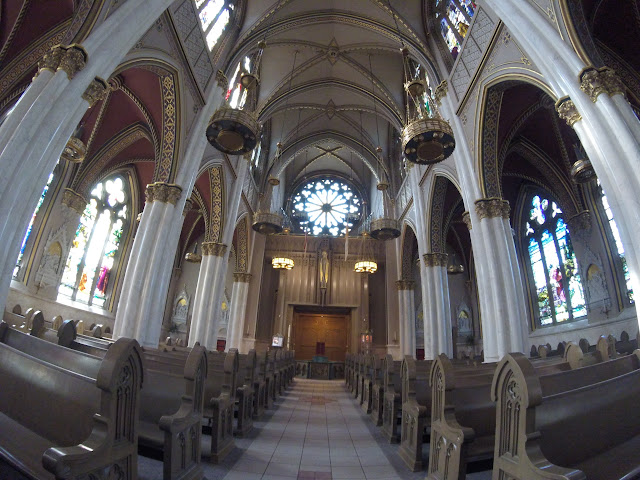
Before leaving Helena, we made a detour to see the cathedral of St. Helena and took a few minutes for quiet and prayer before departing into the wilds again.

Our first map instruction leaving Helena was "Bear right on Grizzly Gulch." We left town to go ride a short day and camp part-way up an extended climb that we would finish the next day. The scenery was different here than we had experienced on our trip previously - more open, less underbrush, and fewer trees in some places.

We camped in a patch of woods on the edge of a forest service road and ate dinner up on top of a cool rock outcropping above camp. We also discovered a new flavor of Knorr rice sides that we had never tried before - Spanish rice with tomato-based sauce... mmm.
Day 17 (8/3/2017)

We woke up and kept climbing until we got up to the Lava Mountain 4x4 trailhead. This was another part of our route where the maps offered an official alternate route to avoid tougher terrain, but we decided to take the main route on this one even though the terrain was supposed to be difficult. In the end, we were glad we did, but it was indeed difficult.

We were not ashamed to push our bikes in lots of places, especially in spots where the trail consisted of a 4 foot deep rut filled with boulders.

However, there area also lots of places where we both surprised ourselves with some of the slightly more technical parts that we were able to ride. In the end, we were glad we did this slow, challenging, but beautiful section - and we felt a lot more hardcore afterward for having made it through and even honed some of our technical skills along the way.

On the way down the mountain, we rode down a valley with some cool old mining ruins.

We rode to the bottom of the valley and stopped for dinner in Basin, MT, a town famous for its "health" radon mines.

We ate at one of the two restaurants in town, the Leaning Tower our Pizza, which had photos of other Divide riders who had come through.
We had a great meal and also squeezed in a few games of Connect Four.

That night we rode about 5 miles beyond town to a large but eerily deserted Forest Service campground called Mormon Gulch full of dead trees and dry stream beds. Our only company were a herd of cows who were grazing the campground. There were no bathrooms, no water, no picnic tables, only fire rings, but the price was right (free).
Days 18-19: She's a Butte!
Day 18 (8/4/2017)
Today we followed one of our map's official "alternate" routes - partly to avoid some difficult terrain (we felt like we were all funned out for now with difficult terrain from yesterday) and partly because of the novelty it offered of legally riding on the interstate for a few miles.
We left Mormon Gulch campground and followed a steep gravel frontage road along I-15.
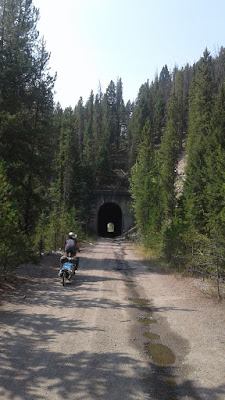
The frontage road gave way to a nice, flat old railroad grade which we continued following through the mountain passage between Basin and Butte. We even got to go through a cool old railroad tunnel labeled "No. 9, 1911" (Eric Rickert, if you're reading this, know that I thought of you. I have no idea when this railroad shut down or which one it was, but I would not be surprised if you do).
One of the few downsides to the new ecosystems we were experiencing on this side of the divide since Helena was the lack of berries we had been finding, but then...
We found a new species of rasberry! New to us on this trip, that is. Mmm...
We stopped for lunch in some of the only shade we could find that afternoon (the area north of Butte did not include many trees - just tall shrubs along the frontage road we were following). Some of our most observant and devoted readers from our East Coast trip blog three years ago may recognize the plastic square near the bottom of the photo. Could it be the same "lunch plate" that started out as a Chick-Fil-A salad lid from dinner that Mama DiGioia brought to us on our first night of our East Coast bike trip three years ago (the first night was still a short drive from Atlanta) and that we re-used throughout our East Coast trip as a lunch plate?
Yes, it is.

On the way into Butte, we crossed the continental divide while riding on I-15. We even went through an interchange to get into I-90 to go into Butte, where we did some re-supplying before heading on.

South of Butte we went into the national forest again and find a remote house with a box of bottled water for Great Divide riders! That night we climbed the divide again for the second time that day and camped at the top, where there was a vault toilet! How luxurious...

Day 19 (8/5/2017)
Before leaving our camping spot on the divide, we took a short hike up a nearby hill, which was a beautiful spot for morning prayer.
Our route frequently intersects the Continental Divide Trail (shown above), which more closely follows the actual divide and probably crosses it even more but is geared more toward hikers than bikers.
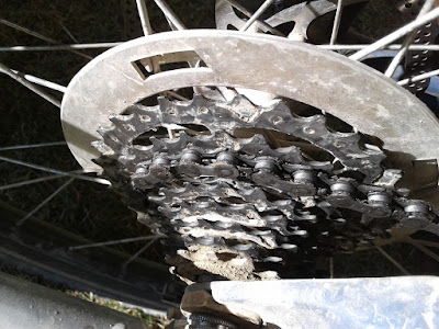
Speaking of gears, we bought a spare toothbrush in Butte which we finally used to clean our nasty chains and drivetrains. My smallest gear on my rear cassette had been literally gathering dust from disuse ever since I excluded its use to try to squeeze a little more precision out of my tweaked derailleur on the lower-gear shifts (which are more crucial and which I use a lot more on this trip, anyway).
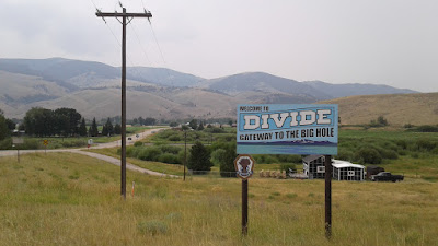
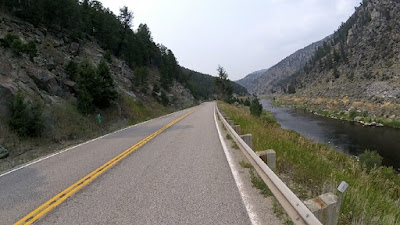
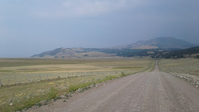
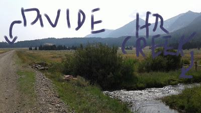
We rode through the little towns of Divide and Wise River following the Big Hole River gorge, which was GORGEous.
In Wise River we turned onto the Pioneer Mountains National Scenic Byway and headed south into some beautiful country which today had a lot of smoke blown in from distant wildfires. It was getting close to time to make camp, and while there are a lot of small campground along this byway, we kept stopping at full ones. Hoping not to play the campground hunting game until nightfall, and also hoping to stay somewhere with water and a pit toilet, we prayed for an open campsite. Well, wouldn't you know it, the next campground we came to had exactly one campsite available, and it was a beautiful one which also happened to be next to some very friendly neighbors - Maureen, Ed, and their friends Aaron, Rebecca, and their son (Rebecca and son not pictured).

They were so friendly and hospitable that they even invited us over for a huge delicious home-made dinner. We had a great time hanging out and talking about our trip and about Montana (where they all live) and also learning that Aaron Anna Rebecca are also civil engineers.
It was such a great evening and great answer to prayer.
Days 20-23: This place is a ghost town
Day 20 (8/6/2017)
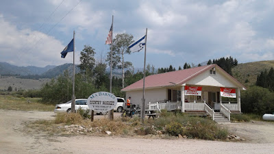
We climbed out of the Wise River Valley and descended into the Grasshopper Creek valley, which was completely different and hardly had any trees. We stopped to resupply at the small Ma Barnes' Country Market off by itself a little way off the byway.
We mailed some postcards in the town of Polaris, MT, whose only two establishments appeared to be a post office and a school.
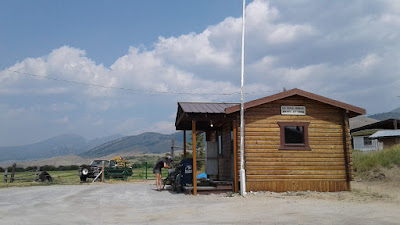
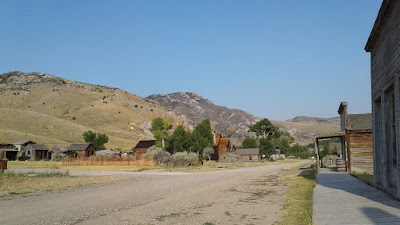
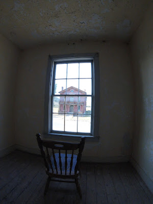
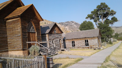
We camped at a state park at the town of Bannack, Montana, whose main distinguishing feature is that it is a ghost town.
We met several other bicycle tourists who were staying there: a California man, a double father-son duo from Pennsylvania (all four traveling together - this was the sons' college graduation present), and another solo rider from Montreal. All were traveling our same route.
Day 21 (8/7/2017)
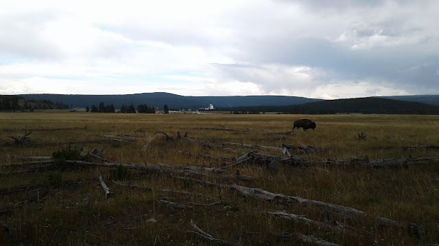
We left the state park and crossed Bannack Bench, a relatively low ridge that took us out of the Grasshopper Valley. We had read that the main route that day (which involved a pretty long, sometimes steep climb) had a detour due to several bridge replacements on the Forest Service roads. We took the detour which was pretty flat and easy (and cut off maybe 10 miles). We passed a herd of bison on a ranch (first bison of the trip) and joked that they belonged to Ted Turner.
The detour also took us through the town of Dell, MT where we stopped at the mercantile for supplies. Outside the mercantile we talked for a while with a local who worked on a nearby ranch (for 49 years I think he said). He told us it was one of the few family owned ranches remaining in the area, as there was a trend of billionaires buying up ranches in that part of Montana. When he heard we were from Atlanta, he said that Ted was one of those billionaires, and that we had passed some of his bison ranch land earlier that day. Fancy that!
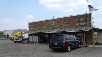

One of the few other establishments in Dell was a restaurant which looked very interesting but which unfortunately closed just before we got there.
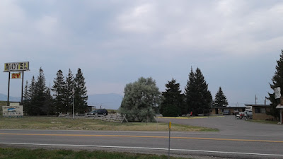
That night we camped at a motel in Lima, MT (pronounced like the bean) that charged $5 for tent camping and also had cheap laundry (we washed our sleeping bag for the first time! Yay!). Lima also has a gas station, a restaurant, and a school among several other small establishments. Everybody in Lima seems to like showing off their Lima Bear spirit (the school's mascot).
What we could not have guessed was that this would be the party motel for all non-car long-distance travelers. There were motorcycle tourists, bicycle tourists, and a whole bunch of Continental Divide Trail hikers.

We talked with a bunch of the CDT hikers, and it was really interesting hearing about them, their trips, and how for many of them this is their second or their half-year-long hike (probably around age 30 or so for a lot of them).
We also got a few sprinkles of rain that afternoon, which was the first rain we had felt in weeks.
Day 22 (8/8/2017)
We had breakfast at the restaurant with a Dutch man named Mike who was going the opposite direction as us on our route. Then we left and rode into the Centennial Valley where we would be for the rest of the day.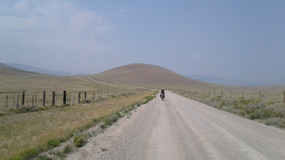
We found a teeny tiny bit of shade to eat lunch under, but soon after that some storms rolled in. This was our first real rain in weeks (since day 3 when we crossed into British Columbia).
We ended up getting hit by some hard rain and sleet then riding out of it. We rode for a while with in storm on our left and another on our right, and we watched them as they moved slowly across the valley and then crossed the mountains without hitting us again. Our pace must have been just right to stay perfectly between them.

The ride through the valley was beautiful.
After about 58 miles (our longest day yet) we arrived at the Upper Red Rock Lake campground in the Red Rock Lakes National Wildlife Refuge where there were also the same father-son double-duo with whom we had camped the last three nights, as well as two guys from the U.K. riding the divide together. One interesting thing about the Red Rock Lakes is their trumpeter swan population, which is one of the largest in the country. We heard them honking on the lake when we woke up in the morning, but they were too far away to see as anything besides white dots without binoculars.
Other important things that happened on this day included seeing a juvenile moose galloping awkwardly across a cattle ranch to a bog, and also me seeing a badger for the first time in real life (it looked just like the one in the Wind in the Willows illustrations).
Day 23 (8/9/2017)
We left our campsite by Upper Red Rock Lake and headed toward a not-too-steep great divide crossing into Idaho. Just before we crossed, we passed the Hellroaring Creek, which is the utmost source of the Missouri River (the fourth longest in the world) at 3,768 miles from the Atlantic Ocean.
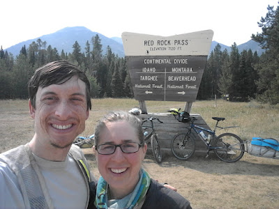
We crossed the divide riding due east, but we crossed into the Pacific side and into Idaho from Montana, which was kind of surprising since we were riding east.
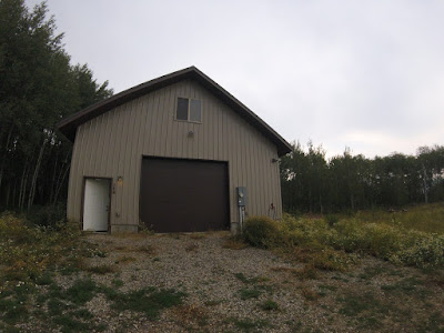
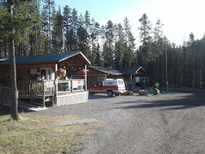
From there we rode down for several miles to Island Park, ID where we arrived at the Man Cave where we had arranged to stay the night then store our bikes while we went into Yellowstone for several days. The Man Cave belongs to an awesome guy named Travis whom we met through the bicycle touring hospitality network called WarmShowers.

While we were there, we took full advantage of having a kitchen and cooking supplies and we made lots of scones to take hiking with us over the next few days (and some to leave with or generous host Travis).
We spent the next several days getting to and hiking in Yellowstone National Park. We just got out of the park today (more details on our time there later) and are now in the process of returning to the Man Cave, retrieving our bikes, and continuing our ride southward.
Days 24-25: Switching gears
Warning: this post contains fewer pictures than usual near the beginning, but there are more near the end :)
Day 24 (8/10/2017)
We began unpacking our camping gear from our bikes to get ready to take it into Yellowstone in backpacks, but we quickly ran into a snag: no backpacks to pack. Travis had kindly offered to lend us his backpacking backpacks for our Yellowstone trip, and we were planning to use these for or Yellowstone mini-vacation, we arrived earlier than we originally said we would, and Travis was not there, and neither were his backpacks. This was our fault for gaining time and changing our plans and arriving early. We began looking for alternatives that would allow us to get into the park on an earlier schedule, like renting backpacks from local outfitter stores, but it turns out that while you can rent ATV's, snowmobiles, bicycles, and a host of other things in the area, nobody rented backpacks. On the plus side, we would still get to backpack in Yellowstone a few days later after our excellent host Travis came with the backpacks... and we took advantage of having a kitchen and cooked ourselves breakfast for a change.
We tried to hold our trip schedule with open hands and not be anxious if our itinerary involved some waiting time. Yellowstone felt so close but yet so far, and we were not exactly sure when we would make it in. We prayed for trust in God whatever our schedule looked like, knowing that any if he wanted us to wait, it would be for a reason. At the same time, we prayed for answers about when we would get to go to the park and for expediency. We can pray both of these things at once, because we believe in a God who invites us to come to him in prayer and bring him our concerns, however big or small, just as a loving father intimately listens to the needs, wants, and cares of his children. While finishing a time of prayer together, my phone rang with a text message from Travis: good news! His cousin was coming to the Man Cave on vacation and could bring the backpacks to us earlier than expected - that same night!
We thanked God for graciously answering our prayer with more expediency than we thought to ask for, and we spent the rest of the afternoon making a 36-mile roundtrip supply run to the town of West Yellowstone (situated just west of the YNP west entrance) to buy groceries and pick up the package we mailed ourselves (actually that Katelyn's dad kindly put in the mail for us) containing hiking boots and other Yellowstone supplies.
While in West Yellowstone, we saw the historic train station that used to bring tourists to Yellowstone, and we thought that was pretty cool.

Remember that train station for day 31, on which (spoiler alert!) we ride on the rail-trail following the defunct rail line that served this station.
That night Travis's cousin Chris arrived at the Man Cave with his two boys for a fishing weekend... and brought the backpacks! We packed up the backpacks and went to sleep, ready to find our way into Yellowstone the next day.
Day 25 (8/11/2017)
The next morning, Chris generously gave us a ride into West Yellowstone where we had breakfast and prayed for a ride into the park.We walked out to the road that leaves town toward the park and put out our thumbs, not knowing exactly what to expect (but knowing from my experience working in Yellowstone eight years ago that hitchhiking tends to at least work well inside the park). We wanted to make it all the way to Canyon Village that day, and because the park is so huge, we anticipated that it may take much of the day if we had to do it in multiple legs since the route passes through multiple junctions. The first car that passed stopped for us, and where were they going? All the way to Canyon! Not only that, but they were stopping to see some of the sights along the way - all the better for us!
Our generous driver was Jill, a local traveling around the area with her Swedish cousin Vanessa. They were so nice and fun to hang out with during our two-hour sightseeing trip to Canyon. Along the way, we got to see the first geyser basin of the trip: the Norris Geyser Basin.

We arrived at Canyon and set up camp at the hiker/biker site, where we were the only ones there - the rest of the campground was full, however. We had plenty of extra time to hike around the area. We saw...

my old employee dorm from summer 2009,

the restaurant I worked in that summer,

the delicious huckleberry ice cream,

and saw the Grand Canyon of the Yellowstone River!

My favorite viewpoint of the canyon has always been the brink of the lower falls of the Yellowstone River.

Watching millions of gallons of water rush past us and tumble 300 feet below in freefall is truly awesome. I have heard Americans accused of overusing the word "awesome," and if that is the case, I'm sure I'm guilty, but this sight is truly awe-inspiring. I am reminded of my place as a fragile creature in the loving hands of an all-powerful, awesome, terrible yet compassionate God. Psalm 42 comes to mind when the psalmist says:
Deep calls to deep at the roar of your waterfalls; all your breakers and your waves have gone over me.That night, Katelyn went to a ranger talk titled "Eat, Prey, Love," then we both star-gazed at the Perseids meteor shower before hitting the sack to prepare for the next day's hike.
By day the LORD commands his steadfast love, and at night his song is with me, a prayer to the God of my life. (Psalm 42:7-8, ESV)
Days 26-30: Into the Woods, on Foot
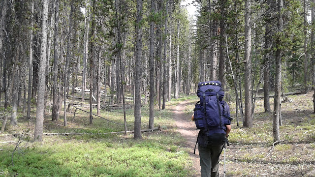
Day 26 (8/12/2017)
With backcountry permit in hand Jonathan and I packed up at the Yellowstone Canyon campground and set off for three days in the woods. We planned to spend five more days in the park and would spend the first three on a hike to "4B1," a backcounty site at the Joseph's Coat hot springs. To get to the site we (1) hitchhiked to the trailhead, (2) hiked 8 miles down the Wapiti Lake Trail, then (3) bushwacked for 2 more miles off trail. This was my first ever experience with bushwacking (map + compass) travel-- I somehow never managed to go on the map and + compass hikes our college's outdoor rec program (ORGT) hosted. Jonathan had been to this site before when he worked at Yellowstone in the summer of 2009 and is versed in map + compass so he lead the way, and I learned a lot. We successfully arrived at Joseph's Coat that evening after a fun day of hiking and set up camp where we would stay for two nights. It was a really special place-- both because Jonathan and our friend David had been there eight summers earlier and because it is so remote. There was no chance of someone happening to go by. It was just us, the woods, the nearby bubbling hot springs, and any wildlife in the area (we saw some birds and bison chips but no others).This is me almost totally eclipsed* by my bulging backpack... we wanted to have all the cold weather gear we might need. *Please consider the use of the word "eclipse" a foreshadowing of what's to come on Day 35.
On the Wapati Lake Trail we saw the biggest mushroom we've ever seen. We wished we knew whether or not its edible... any insight from our blog readers? It looks like someone took a few nibbles before us : )

Day 27 (8/13/2017)
We woke up, just us and the woods, and headed out for an out-and-back bushwacking adventure. We spent the day attempting to reach Fairyland-- a special canyon area of unique thermal features which for me had taken on mythical proportions (and with just cause with a name like that!). Jonathan and David had reached the edge of Fairyland back in 2009. We didn't make it this time, but had a really good time walking through the woods. We made the decision to turn back when we gauged our progress and knew we wouldn't make it to Fairyland with enough daylight to get back to Joseph's Coat.Its hard to describe what it was like for me to navigate through the woods by map + compass. Its nothing like wandering around-- there's a concentrated purpose and specific destination in mind. You're relying on the unseen magnetic force of the earth to guide you. Jonathan described to me previous map + compass experiences he's had where he and his group tried to take short cuts in the method, usually with bad results. He aptly noted that people are really bad at walking in straight lines without the compass providing direction-- we walk relative to what's around us, in this case the trees and contours of the land would bend us from our bearing if we weren't continually checking the compass.
The Bible verse 2 Corinthians 5:7 came to mind: "we walk by faith not by sight." Meditating on this verse while we hiked, it made the concept of "faith" more tangible for me. I can usually ignore the magnetic force of the earth, but with our map and compass this usually intangible force became tangible-- and it led us exactly where we wanted to go. God has a powerful hold on my life-- directing me into adventures that can be beautiful, hard, boring, surprising, painful, or sweet (usually some combination). Even though I can't hold those directions in my hands, I can walk by faith. Faith here isn't the opposite of sight (blindness), it's a better way to travel.
We did a lot of bushwacking over deadfall. There were a whole lot of trees to step over which made for slow going.
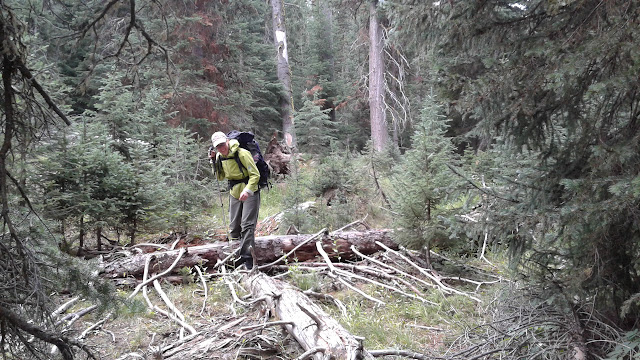
Here's Jonathan taking a bearing. The trees in the background were burned in an old fire, Many still stand.

We made it back to our Joseph's Coat campsite. In the afternoon it started to sprinkle on and off...
Day 28 (8/14/2017)
...overnight it rained a lot and we woke up to intermittent rain. We took advantage of a gap in the showers to scramble out of the tent, pack up, and eat a row of fig newtons for breakfast while the rain picked up. Unlike in Georgia where it can still be quite warm during summer storms, it gets real cold when the sun's not shining out west. So, rather damp and quite cold, we set off on the reverse hike of day 26 (2 miles of bushwack then 8 miles on the Wapati Lake Trail). We had one more layer of clothes that we could have added, but opted to hold that in reserve for emergencies and hike fast in hopes of keeping our body temperature up high enough. We were cold and our legs were soaked but we made it back to the trail. It was a "this will be a good memory but right now I'm just cold," kind of feeling......but I smiled for a soggy picture!
Later in the afternoon the sun came out! We praised the Lord considerably for that. We dried ourselves up in the sun and then washed dried the rest of our gear at the Canyon Campground Laundromat, which was fun. We camped at the frontcounty Canyon Campground that night.
Day 29 (8/15/2017)
The next day we hitched over to Old Faithful so that I could see a new area of the park. Even the ride over there was beautiful, and then a few minutes after we arrived Old Faithful did its thing and erupted!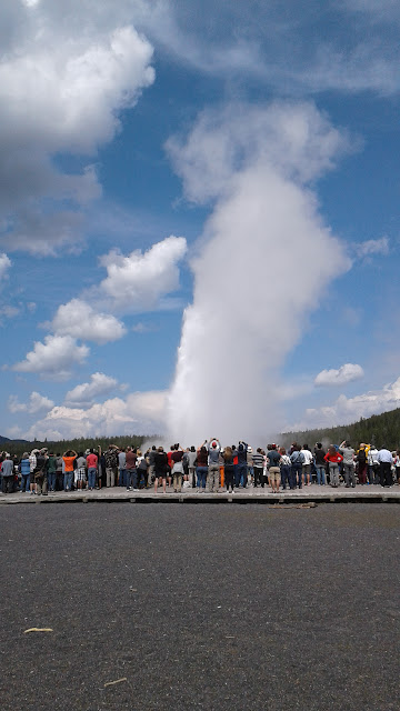
After watching Old Faithful and eating a PB+Nutella on bagel lunch on the upper deck of the Old Faithful Inn we set off around the boardwalks to see the other nearby thermal features. The thermal features were really cool but the best part was...

...unexpectedly running into friends from back home-- Ryland and JP-- what a great surprise!
There's not a frontcounty campground in the Old Faithful area so we tried to pick a backcounty site that would just be just a short hike in as we'd be starting late in the day. It turned out that these sites are in high demand. We were able to book one site that wasn't super ideal, but then the ranger Jonathan was working with to book the site also told him about an ADA accessible site that is reserved until 4pm for people with specific physical mobility needs, but if its not taken then anyone can use it. First we were impressed and glad that the park had this kind of site, then we were glad when we were able to book it for that night. The two mile hike in was on a smooth gravel path, and along the way we saw a bison (my first in the wild!).
The campsite was beautiful,
and it had a kind of pit toilet we hadn't encountered before. I was really interested in it from an ADA-design perspective, and appreciated using it too : )

Day 30 (8/16/2017)
We woke up at our beautiful site near Old Faithful then continued on a loop hike that took us by Fairy Falls (not to be confused with Fairyland but still lovely). This would be our last day in Yellowstone-- after the hike we planned to hitch hike back to Travis's man cave to recollect our bikes and continue south.
Our hike took us by the overlook of the Grand Prismatic. How cool is that hot spring?
 But then it was time to go. Our hitch hiking experience in the park was really great-- we never waited more than 20 minutes. We are so thankful to all the folks who gave us rides. Each person/couple stands out in my memory as much as the awesome natural features of the park. Each person had a unique story and we really enjoyed the sometimes brief, sometimes long rides we shared. Jesse, pictured below, really stood out. First off, he has an awesome Sprinter van that he customized, inside and out, and secondly because he's living in the van and driving around the county sharing his story of getting sober of how its changed his life. He drove us all the way from Old Faithful to the town of West Yellowstone, outside the park.
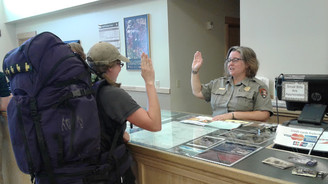
In West Yellowstone we had to stop at a food stand called Yellowscones (we just loved the punny play on words). Here we learned about western scones which are fluffy and fried and not anything like the Scottish scones we were used to. There're delicious, and pictured below with huckleberry jam on top.
There's also conveniently a ranger station in town, even though its outside the park, so I had the opportunity to be sworn in as a Yellowstone Junior Ranger. To become a junior ranger you have to (1) hike on a trail, (2) go to a ranger program, and (3) complete a really comprehensive (and fun) workbook. Having successfully completed these prerequisites I was proudly sworn in. I'm wondering if I can put this on my resume when Jonathan and I someday pursue our dream of working at Yellowstone again ; )
After completing our post-Yellowstone errands in West Yellowstone we hitched back to the man cave (this was our most surprising pick up-- by a tour guide with his Chinese tour group and us all squeezed into their van!). I'm so thankful for the time we got to spend in the park-- for the people we met and the beautiful and unique things we got to see. Its a special and unforgettable place.
Stay tuned for future blog posts on the next several days of riding which brought us to the Grand Tetons National Park, then several more days of riding that brought us to Pinedale. We're heading out of Pinedale today (8/26), and we're on track for getting to the Breckenridge/Denver area arriving back home September 9th.
Days 31-35: Total eclipse of the park
Day 31 (8/17/2017)
After a good night's rest following a great Yellowstone vacation, we spent a long morning at the Man Cave re-packing our things in biking mode as well as doing various chores on the internet.We finally left around 2pm and rode to the Warm River Rail Trail where our journey continued southward. The rail trail was an old railroad bed that had been converted to a multi-use (bike, hike, equestrian, snowmobile, atv) trail. Originally built in 1908, this was the railroad that took passengers from Salt Lake City to West Yellowstone via Ashton to access the park. Remember the old railway station in West Yellowstone? This was the railroad went there. The railroad was later owned by Union Pacific who operated it through 1979.

A cool old tunnel along the rail trail
At the end of the day, we camped at a nice National Forest campground called Warm River. Apparently the river was not all that warm (like 50-something degrees); it is just warmer than some other rivers, especially in the winter.

We camped near two men, Mike and Ken, who were friends doing the Great Divide together; there was also a family who camped near us who lived nearby and were doing several days on the rail trail together.
Day 32 (8/18/2017)
We left Warm River and climbed up into a different landscape than we'd seen in a while - agriculture (in this case, wheat and potatoes) with the Tetons as the backdrop.
We saw Mike and Ken several times along the trail and talked a good bit. They also took some of the few pictures we have of both of us on bikes...

That day we biked into Wyoming!

and ate lunch by Indian Lake.

The riding was beautiful all day. Toward the end we rode through an area where there had been a fire last year, and the wildflower display was beautiful.

Unfortunately, that fire had also destroyed some of the campground options in the area. All the campgrounds in the greater Teton area (where we now were) seemed to be full due to the solar eclipse coming the days later, but we find a "dispersed" spot to camp near a trailhead by Sheffield Creek Forest Service campground. The trees in the area were small and not very conducive to hanging our food in overnight, but a nice man in the campground let it's store our food in his horse trailer.
Day 33 (8/19/2017)
We got up at 4am, left our dispersed site at 5:30, and began riding in the cold and the dark to hopefully get a jump on Grand Teton National Park traffic before things got too crazy. The goal: get into Grand Teton, get a campsite, then hang out for the weekend and watch the eclipse from inside the park. Our only concern was that thousands of other Americans had that same goal, since Grand Teton is within the eclipse path of totality and would be an amazing place to watch it. Hence the early start.We were concerned about traffic and whether or not we would get a campsite. Thankfully, everything worked out great, and our fears were unfounded. Traffic was not bad, the roads had good shoulders, and while the campground at Jenny Lake (where we wanted to stay) was "full," the hiker/biker sites were not! So we got a great campsite along with the other folks who arrived by foot and bike.

We even saw our fellow bicycle tourist friend Nina, here from New Zealand following a different route than us, whom we met in Glacier National Park! What a great surprise!
That night, we did what we had been wanting to do the whole trip: make a campfire and invite our neighbors over for s'mores.

Day 34 (8/20/2017)
We slept a little extra this morning after our 5:30am departure the morning before. It was Sunday, and we hoped to make it to a worship service inside the park if one was happening. We knew there was an organization called "A Christian Ministry in the National Parks" who holds them during the summer, because this is the organization I volunteered with while I was working in Yellowstone during summer 2009. However, since arriving in the park, we had not been able to figure out if worship services were still being held this late in the summer, since a lot of ACMNP volunteer staff are college students (like I was when I worked with ACMNP). We also were not sure how we would get to a service location, as the flyers said they were not being held in our campground due to amphitheater renovations.We did what seemed like the right thing to do in our situation: we prayed and asked God to make a way for us to get to a worship service if that was what he wanted us to do, then we went out to the road to hitchhike to the nearest service location (the park is so big, we would have been too late if we biked).

God answered our prayer by sending an off-duty driver for a multisport outfitter company who took us all the way to Signal Mountain campground, where we got to participate in Sunday worship with other believers for the first time on our trip.

It was such a blessing to us getting to worship and fellowship with other believers on a Sunday. It was a refreshing experience. And it was followed by another fun and refreshing surprise: getting to eat at the employee dining room with several ACMNP staff! Not only did it bring back fun memories of being a park concessions employee in Yellowstone, but we also got to enjoy all the fresh vegetables we could eat!... rarity for trips like this.
We had a very restful afternoon around the campground, and we took a short bike ride for a scenic dinner picnic next to String Lake.

Other exciting things that happened today include meeting a bicycle-traveling photographer named Mike, whom we met near the visitor center. He was in the middle of wondering where he would spend the night, when we told him about the park's excellent hiker/biker camping. He was thrilled and joined us in the hiker/biker section of the campground. We also learned that we both planned to hike to the same spot the next day to see the Great American Eclipse.
The other exciting thing that happened was when a mother black bear and her cubs walked through our campground. We were just about to start night #2 of s'mores when the campground host came barreling through the campground in a golf cart shouting "put away your food now!" We did, and next thing we knew, there were bears walking along the edge of our hiker/biker site. Thankfully, they did not want any trouble... They were just traveling through.
Day 35 (8/21/2017)
We woke up at 4am to start a long hike up to Lake Solitude to see the Great American Eclipse in its totality. The hike was a beautiful 9-mile trip up Cascade Canyon. We saw lots of beautiful waterfalls coming into the side of the canyon, which reminded me of Psalm 104 which praises God for the beautiful and amazing ways in which he sustains the world he created.
From your lofty abode you water the mountains; the earth is satisfied with the fruit of your work. (Psalm 104:13, ESV)
We made it up to Lake Solitude, a high- altitude lake where we would watch the eclipse.

There were about 20 or so other folks scattered around the lake with is to watch it, many of whom were photographers.

We also saw our new photographer friend Mike again, who was shooting material for his next book on night sky photography (mikeshawphotography.com).

The eclipse was a truly awesome experience.

I cannot describe the experience in a way that does it justice. I will day that one of the most surprising parts was how cold it got leading up to totality. The sun appeared to be at full strength illuminating the landscape, but we kept having to add layer after layer of jackets just to stay warm. It took us a long time to connect the dots and realize that the creeping cold was due to the moon blocking more and more of the sun's heat! And up here in the Tetons, that meant cold.
After the eclipse, we hiked further up to Paint Brush Divide then hiked back down Paintbrush Canyon. It was a day full of beautiful hiking and breathtaking views.


And...

There were huckleberries to eat on the way down!
This was our last day in the Tetons before riding on to continue the route.
Days 36-38: Earth, Wind, and Absaroka
Day 36 (8/22/2017)
We packed up and got ready to leave Grand Teton National Park, but as we were packing, one of my bike's shifter cable housings got tweaked, which threw the shifting on the rear side out of whack... poor Buttercup... (Buttercup is the name of my bike). I threw on some good ol' electrical tape and then took the opportunity while I was adjusting stuff anyway to finally install the shiny new derailleur hanger I had picked up at the West Yellowstone bike store. It was great! My bike shifted like new again!After our late start, we rode out of the park east along U.S. 26 then turned off onto Buffalo Valley Road. On the way, we picked up some more HEET at a gas station to power our alcohol stove. We still had some iso-HEET (red container), which we had nicknamed "atomic HEET" because of the large fiery ball and copious soot it creates when you cook your food over it, but we were growing tired of cooking over a fireball, so we wanted to switch back to the yellow kind.
On the Buffalo Valley Road we stopped off at the Buffalo Valley Cafe, which had been recommended to us earlier by our excellent Man Cave host Travis.

The bison burger and grilled cheese were excellent, but the home-made huckleberry milkshake was the best part. It was so good, it was gone too fast to take a picture of.

That night we camped at Turpin Meadows campground, which used to be closed to tent camping because of aggressive grizzly bears... but now it's not! We also met a cool couple touring the Divide with B.O.B. trailers (like us) and DaBrim helmet visits (also like us).

We also met a retired foursome comprised of two sisters and their husbands whom we would see a lot of the next several days along the route.
Day 37 (8/23/2017)
In the morning we climbed a big hill away from the Buffalo River and had some beautiful riding through forests, meadows, and past beaver ponds (we saw another beaver!), always on the lookout for moose and grizzly bears. We did not see any, though.We crossed the continental divide again at Togwotee Pass

then stopped for lunch beside Wind River Lake, the headwaters of Wyoming's Wind River.

We passed the B.O.B. couple and the foursome whom we had camped with several times during the day. We also climbed "Lava Mountain 2.0," the second geographic feature named Lava Mountain on this trip (the first was a little ways south of Helena, MT). The name kept reminding me of one of the courses in Mario Kart: Double Dash, a course whose centerpiece is a volcano with angry eyebrows that spews lava throughout the race, which also happens to be one of the DiGioia siblings' favorite courses to race each other on (David, do I still have the time trial record on that course and on Rainbow Road, or did you ever manage to exceed me?). However, I realized that the Mario Kart course I was thinking of is actually called "DK Mountain," not "Lava Mountain," despite the lava. Alas. However this Lava Mountain that we climbed was strewn with actual lava rocks, which was pretty cool.

The weather kept looking like it was about to rain all the way up. It even sprinkled on us a bit. We were hoping and praying that it would at least hold off until we set up camp, because it was getting chilly, and thankful it did hold off until after we were asleep. After crossing Lava Mountain, we camped in a scenic open area near the Green Creek. And it had a bear box and vault toilet!

Day 38 (8/24/2017)
The day's ride started out with some ups and downs along forested gravel roads, then before long we came to the big, long climb up to Union Pass. Three mountain ranges come together in the vicinity of Union Pass: the Gros Ventre range (which shares a name with a Native American tribe which called themselves the "white clay people" but whose name was mis-translated into French as "Gros Ventre" or "big belly"), the Wind River range, and the Absaroka range. There is also a triple divide nearby where water may flow to the Mississippi River, Columbia River, or Colorado River.
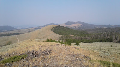
When we got up to Union Pass, it was cool and windy, and the scenery took a turn for the alpine. The we rode through the high county for a long time, gradually descending. It was beautiful.


Throughout the day, we passed back and forth with the foursome we had been tracking along with over the last few days. Near the end of the day, we rode down into the Green River valley and stayed in a very cool, very cute cabin built by a man named John and made available free of charge to cyclists by him and his wife Lucy. We enjoyed getting to know them and were so thankful for their generosity in hosting us.
Days 39-40: Pining for Pinedale
Day 39 (8/25/2017)
We woke up in John and Lucy's lovely cabin, packed our things, then ate breakfast and did our prayer and Bible reading on the porch of the cabin.

We rode on toward Pinedale, where we had reserved a room in a bed and breakfast for the night -- our first planned indoor lodging since the Man Cave a little over a week ago (John and Lucy's cabin was not planned far in advance, and being indoors then was a pleasant surprise!). On the way, we stopped for a lunch and postcard-mailing break at the Cora, WY post office. It turned out to be a very cool place one of the only buildings in Cora, this post office used to be a general store, and it still has historic general store merchandise and decor in the front.


That afternoon, we arrived in Pinedale, WY, a big small town with our first grocery store since West Yellowstone. Historically Pinedale was a big cowboy town, and it still has a lot of that character today.

When we arrived, we made a trip to the laundromat, which happened to have about 12 more deer, elk, and moose heads on the wall than our laundromat back home.

Also in Pinedale, we got ice cream, grocery shopped (including buying our first chocolate Teddy Grahams of the trip -- something our friend April accidentally got is hooked on after staying with them on our East Coast bike trip, and which we had been craving on and off on this trip), tried to visit John and Lucy's son's saddlery (which was closed when we got there), and ate dinner at the Wind River Brewery, where we once again saw the same foursome we had been tracking with over the past few days.
Day 40 (8/26/2017)

We so enjoyed our time at the bed and breakfast, including, not least, the breakfast! It was so good, and they made so much for us.

We spent the majority of the day in Pinedale taking a near-zero day (or "nero day," as it was called by a hiker lady named Jan whom we ran into twice around the small town). We actually spent most of the day in the Pinedale library doing things like writing postcards, blogging, checking email, downloading topo maps for the route ahead, and figuring out how we would get back home to Atlanta. We also made a trip to A-Z Hardware, which doubles as the town's bike shop, to get Katelyn's noisy bottom bracket checked out (there were no apparent critical issues).
Late in the afternoon when it was time to move on from Pinedale, we took one more trip to the grocery store to ensure we had all we needed for the next several days' stretch with very limited commercial services, then we rode out of town. It was a little sad leaving Pinedale, because we had enjoyed our time there so much.
After a short 10-mile ride (hence the "nero day"), we arrived in the much smaller town of Boulder, WY where we would stay for the night.

But before checking into our campground, we did something we had been looking forward to ever since we arrived in Pinedale -- attend Connie's birthday party!

We had not met Connie yet, but we had seen invitations to her 80th birthday party in public places all over town, and we thought she sounded cool. It turned out, she was! When we arrived at the Boulder community center for her party, we were greeted by Connie's children who welcomed us and told us that Connie would be genuinely happy to have us here and meet us. They also asked us if we were the couple Connie had met at the brewery the night before and invited then, which we were not, though we were at that same brewery the night before, probably while Connie was there. We met the birthday girl, who was lots of fun to talk to, and we also got to enjoy a great western potluck with a bunch of friendly, welcoming locals!
One of the conversations I overheard that was most interesting and foreign to me was two men talking about somebody they both knew who went out hunting and shot what he believed to be a black bear. According to them, he then got in trouble with Fish and Wildlife, because they believed he had illegally killed a grizzly bear. Fish and Wildlife proceeded to do a DNA test on the dead bear, concluded that it was indeed a diseased grizzly bear with no hump on its back (normally a distinguishing feature between black bears and grizzlies) that had wandered outside of the typical range for grizzly bears, and then they preceded to charge him with illegally killing a grizzly. The two men talking sided with their hunter friend.
That night we camped in the High Line Trail RV park (which happened to be next door to a llama ranch) and prepared for full day of riding into the desert the next day. When we checked in, the campground manager and his wife were in their trailer watching the Atlanta Braves play the Denver Rockies in Atlanta. The Rockies won.
Days 41-44: All about that basin
Day 41 (8/27/2017)
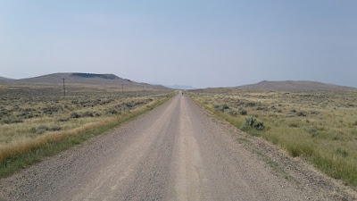
We left the RV park in Boulder and followed a road out of town and down into the desert. We had already stocked up on food and increased our water carrying capacity, because we would be spending the next four days crossing part of Wyoming's Red Desert, including crossing part of the Great Divide Basin.
We crossed the Big Sandy River then turned onto Lander Cutoff Road, which roughly follows the Lander Cutoff of the Oregon Trail. This cutoff provided a shorter route for Oregon Trail travelers and was the first federally funded road project.


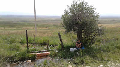
We had lunch by the Little Sandy Creek, one of the precious few flowing water sources we passed during the day. Of course, we refilled on water here. We pitched a tarp for shade while we ate.
 |
| Lunch on the Oregon Trail |
See those wagon tracks to the left of the tarp? Remember that educational computer game about crossing America by wagon train? We're on that Oregon Trail. Only we have it much better than those folks did.
After we ate, we saw the same foursome of Divide tourists arriving at the creek as we were getting ready to leave. After we got back on the road, we encountered a new group of four whom we had not met before.

They were four friends doing the route in sections two weeks at a time and supported by two more friends who carried their food and camping gear for them in a van. We spent a while riding and talking with Miles, a member of the group who was willing to stay back at our pace for a while.
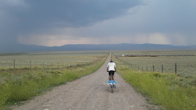
We spent some time riding along the continental divide itself, straddling the Atlantic and Pacific basins.


That night we camped at another water source, the Pine Creek between South Pass and South Pass City, and had dinner on top of a rock outcropping above our campsite.


Day 42 (8/28/2017)
That morning before leaving we did our Bible reading on top of the rock outcropping by our campsite. We were a little over 40 days into the trip at this point, and we were one day into a four-day desert crossing.
Over the course of this trip, we have been reading together the Old Testament account of the Israelites' 40 years in the wilderness after the Exodus. It has been a unique experience reading this while traveling through the wilderness ourselves. While there are probably more differences than similarities between our trip and the wanderings of the Israelites, being in the woods and the desert has still brought with it a heightened sense of vulnerability (e.g. to weather, thirst, injury) that is different from what we experience on a typical day back home and that brings us closer to the story. Before we left for our bike trip, we were reading the book Celebration of Discipline by Richard Foster as a "summer reading assignment" along with other members of our church. As a result, Katelyn and I both came away with a better appreciation for the role of meditation in the Christian spiritual disciplines. The Lord put this section of wilderness scripture on our hearts toward the beginning of the trip and gave us the opportunity to practice meditating on it throughout our trip. As it turns out, long stretches of desolate roads can provide great opportunities for meditation... as can long, grueling uphills.
But today, we did not read about the Israelites in the wilderness. Instead, we moved on to Matthew 4, where we read about Jesus -- the son of God walking the earth as one of us -- and his time in the wilderness following his baptism.
We read how Jesus was tempted by the devil after fasting in the wilderness for 40 days. That is about how long we have been on our trip, but forget about our one summer sausage per week, our pound of cheese, 10 bagels, 1-2 pounds of oatmeal, 5-10 packets of Knorr Rice Sides, the Clif Bars, chocolate Teddy Grahams, chocolate granola, and all the many, many other snacks. We read about how Jesus resolutely rejected each temptation, quoting scripture and keeping a clear head about who he was and his purpose, despite his hunger and fatigue.
I was struck by both the parallels and the contrasts between Jesus' time in the wilderness and that of the Israelites (about whom we have been reading previously and whose events have many, many more chapters covering them). When the Israelites were led by God into the wilderness, they had a clear sense of purpose and trusted in God for their safety, guidance, and everyday provisions. This only lasted a little while, though. Before long, they were complaining and seemed to completely forget how God had miraculously and consistently provided for them. They quickly reverted to only thinking about themselves. Time after time God would remind the Israelites of their foolish shortsightedness (often by disciplining them), they would repent and snap out of it, and God would patiently continue leading and providing for them... only to watch them forget him again... and then again.
I tend to follow the Israelites' pattern more closely than the example of Jesus. As a side note, the song that keeps getting stuck in my head ever since riding into the desert is "Horse with no Name" sung by America, which says that "In the desert you can remember your name, 'cause there ain't no one for to give you no pain." This song was not true for Israel who quickly forgot their name and purpose, but when Jesus went to the desert, he remembered his name and his calling perfectly (despite there being someone there to give him pain).
But there is another scripture parallel here. When Jesus went to the desert, he remembered his name and accomplished what the children of Israel failed to do when they were there. In the same way, when Jesus came to earth as a man, he accomplished what mankind's forerunner Adam failed to do: to live a life fully pleasing to and in communion with God. It is because of this and only this that we can have any hope of peace and communion with God -- by accepting God's free gift of grace based on the perfect work accomplished by Jesus in his life, death, and resurrection. This was my meditation for the day in Wyoming's Red Desert.
After riding out of camp, we quickly came upon South Pass City, WY -- another ghost town.

This town, which still actually has a few residents living on one street, has a similar story to Bannack, MT: a gold rush town of former statewide significance that virtually fell off the map when the gold industry fell on hard times. One of South Pass City's claims to fame, however, is that the first female justice ever appointed in the United States was appointed there.


Something else interesting about our experience in South Pass City was the fact that almost everybody we met there were either Great Divide tourists or CDT hikers. We met John, the CDT hiker from Alaska; a couple riding northbound on the Great Divide who gave us encouraging intel on the road ahead (Diagnus Well is a good place to camp, and the A&M Reservoir still has water in it); and Ian, whom Kateyn met at the Pinedale hardware store/bike shop (then with his old companion Dave). Ian was now joined by new companion Tommy (now nicknamed Dave 2.0).
After South Pass City, it was a short ride to the next town of Atlantic City, WY. This town joins Pole Bridge, MT on the list of non- ghost towns we've visited that have no paved roads either within them or leading to them. This town has twice as many saloons as Pole Bridge, but unfortunately no free hiker/biker pastries the food we had for lunch at the saloon was great, though!

While we were there, the saloon filled up with cyclists. Ian and Tommy rolled in behind us, and the same foursome we met at Turpin Meadows showed up also.

After a long lunch break in Atlantic City, we climbed out over a steep ridge, leaving behind the last inhabited place and the last trees we would see for three days. What we saw on the other side was an endless expanse of rolling golden high desert below us.

The other thing we found was extremely bumpy "washboard" road surfaces (captured somewhat in photo above), which are nothing new for this trip, but which are like biking over a million tiny speed bumps and have a similar slowing effect, shaking your bones as you go. This was a bit demoralizing for a while, but eventually they did let up, and we still made it to camp before dark. On the way we also met a 75-year-old CDT hiker named Solar Sam to whom we gave some rasberry lemonade.
We camped at Diagnus Well, an artesian well out in the desert.

We were also joined by Ian and Tommy, who shared with us some of the jalepeño poppers and cheesecake they had bought in Atlantic City. Mmm... While making a late dinner, we also got to witness a beautiful desert sunset.

Day 43 (8/29/2017)
The next morning we left camp a little after sunrise. The temperature quickly went from chilly to fairly warm. We passed a shepherd's living quarters (at junction in distance)
and then later the shepherd and his sheep.

We also rode through the Bison Basin oil field.

We were soon passed by the group of four supported riders we had talked with two days before. Their friends Jeff and Leslie who were supporting them set up a lunch stop on the side of the dersert road with sandwiches and shade, and they shared both with us! It was so nice!

We entered the long-awaited Great Divide Basin -- the geographic anomaly in which the continental splits in two, leaving a basin in the center in which rain water neither flows to the Atlantic nor the Pacific; it just goes... nowhere... until it evaporates.


We also saw...

(For those of you who appreciate the Bill and Ted reference)
... some of the feral horses that make the Great Divide Basin their home.
The third- or fourth- most pleasant surprise we got that day was a lovely little cloud that blew along in our direction of travel and gave us shade for a while in the afternoon.

The most pleasant surprise we got was getting to share camp and a big dinner with our four new friends from the last few days Lars, Hans, Miles, and Chuck, as well as their excellent support crew Jeff and Leslie, and our other recent rider friends Ian and Tommy. Jeff and Leslie made an amazing dinner of spaghetti and salad, and we contributed some of our cheese :)

Not only did we enjoy getting to share camp and a great meal with a bunch of our new riding friends, but this was also the realization of our fantasy developed over many long days of riding that someday, maybe we would find ourselves camping with some kind supported riders who would invite us to eat their food and store our food in their car instead of hanging in a tree (which is a daily ordeal). It actually happened! (The food storage part wasn't really necessary because of the lack of bears in the middle of the desert). Thanks, friends!
We also enjoyed our camping spot by the mini-oasis of the A&M Reservoir, as well as another beautiful desert sunset.


Day 44 (8/30/2017)
The next day we had a fairly smooth ride to the other edge of the Great Divide Basin.


We climbed up out of the basin and were quickly in civilization again in the town of Rawlins, WY. Fun fact: Butch Cassidy (think Butch Cassidy and the Sundance Kid) spent some time in prison here and also robbed a train not too far from this town. On the way, we passed two CDT hikers walking down the highway whom we had seen way back in Lima, MT. They were moving fast!
We treated ourselves to a motel room in Rawlins and dinner at Buck's Sports Bar with Ian and Tommy.

The next morning we spent some extra time in town finalizing our travel plans for getting back to Atlanta. We decided to leave the Great Divide route after Steamboat Springs, ride east through Rocky Mountain National Park, finish riding in Denver, then drive a rental car all the way from Denver back to Atlanta.
Days 45-47: Rocky Mountain high
Day 45 (8/31/2017)
We left our Rawlins motel late in the morning after working out a lot of trip-finishing logistics and rode on into the what would now be our last three days on the official Great Divide route.As soon as we rolled out of our motel, we were hit by a relentless cross wind that stuck with us for the next seven hours as we climbed away from Rawlins, out of the desert and toward the continental divide. We took off our classy DaBrim helmet brims to prevent our heads from being blown sideways all day. I was amazed that the wind never let up for a single minute the whole time we were on the Rawlins side of the divide. On the plus side, the riding was beautiful.


...despite the long, grueling divide crossing.

(It was bigger and longer up close).
That night, after crossing out of the BLM lands and into the Medicine Bow National Forest, we arrived around dusk to our dispensed campsite by the Little Sandstone Creek. Ian and Tommy were camping there, too, and as we were arriving, they built a wonderful campfire!
Day 46 (9/1/2017)
The next morning, we left our campsite and rode through a section of the forest road known as "Aspen Alley."
We rode out to Wyoming highway 70 and came across our four supported friends and their excellent support crew, whom we rode with for a little while (until they got ahead of us as per usual).

Highway 70 was a long, fast downhill ride that put us into Colorado in the metropolis of Slater.

There was not a state welcome sign, so I took a picture of the Slater, CO post office instead.

We took an oversize lunch break in a peaceful, shady spot by the Little Snake River and tried to find a place to stay two nights later in Steamboat Springs, CO, which we thought would be easy, but we were also forgetting that the rest of America was not on a calendar-less bicycle tour and were observing Labor Day that weekend. Everything appeared to be full, and there did not appear to be any good camping options within easy access of town. We tried reaching out to several potential hosts on warmshowers.org, but we had to leave messages and wait until the next time we had cell service to check them. It was a little stressful, and this was one of those times where we think we are really chill about whatever comes our way and ready to trust God with our needs, but then that gets tested, and we find out we still have some room for growth in that area.
After our long lunch break we started up the Slater creek watershed, where we saw some of the first oak trees I've seen since I don't know how long (Atlanta?), scrubby though they were. Around 5:30pm, we were planning to ride further into the evening to give ourselves a shorter day into Steamboat Springs the next day, when we passed by the Brush Mountain Lodge, where it turned out all our friends from recent days were staying. They beckoned us in, and the proprietor Kirsten came over and welcomed us with a hug and a freshly cooked wood stove pizza, and they all begged us to stay. We protested that we needed to get further down the road to shorten the next day's mileage, which included a significant climb up a steep mountain, but then Kirsten said she had an extra indoor cabin for us at the cyclist rate of half-price and could cook us breakfast in the morning. We were sold. We also felt more comfortable making this decision since Leslie and Jeff generously offered for us to stay with them in Steamboat Springs if we did not find a place to stay before we got there.
Throughout this trip bike trip, Pilgrim's Progress parallels keep coming to mind along the way as we meet different people and experience different things that remind us of Christian's experiences. But we were hoping this was not a Vanity Fair but rather a Pleasant Arbor or a Palace Beautiful where pilgrims can go to find rest (before climbing the Delectable Mountains the next day). We think it was more of the latter :)


We were really glad we stayed. It was great hanging out with our new riding friends Ian, Tommy, Chuck, Miles, Lars, and Hans, and the excellent support crew Jeff and Leslie. We also met Malcolm, another Divide rider from England, who was laying over at the Brush Mountain Lodge for a few days. The dinner was great, the room and shower were great, the HOT TUB was great, and we got a great night's rest.
But the big question was: where are Ari and Kirsten? (our Australian friends whom we met on Day 1) We had not seen them since Glacier N.P. We asked the proprietor (also named Kirsten) if she had seen them yet, and she had not. We suspect they may be nearby, though.
Day 47 (9/2/2017)
The next morning, Kirsten made us a huge, delicious breakfast to start the day.
After breakfast, we said good-byes to our great riding friends and excellent support friends we had made over the last few days, not knowing if we would see them again later in the day. This was our last day on the official route, and it was the same for Miles, Chuck, Lars, and Hans. Ian and Tommy would continue on beyond Steamboat.

After we left, we rode further up the Slater Creek watershed before beginning a very abrupt, very steep 1.5-mile climb up the infamous "Watershed Divide." Actually I'm not sure how infamous it is, but I think this climb was the reason our map provided an alternate route around this area (which we did not take).


After a challenging but rewarding climb (which included its share of huffing, puffing, and pushing), we crested the Watershed Divide near Meaden Peak and found Lars, Miles, and Chuck!

I'm pretty sure this was the highest point we pedaled to on our trip so far at 9,840 ft, hence the title of this post (though we were in Colorado during this part of the route, we did not partake of their new state plant ;) ).
We rambled down the steep, rocky descent into the Elk River watershed on the other side of the divide (not to be confused with the Elk River whose valley we rode through for several days in British Columbia) then continued downhill on a fast paved road all the way to the Clark Store -- a combination general store, post office, library, liquor store, and ice cream shop -- where we found Ian and Tommy again and ate lunch in the shade while we hung out with them for the last time on the trip.

While we were at the store, we got cell service and learned that a warmshowers.org host had offered to host us in Steamboat Springs. From the store, we rode on into Steamboat, which was mostly downhill and relatively quick, and soon arrived at our host Richard's house. It was really nice getting to stay with him and his wife, and they live right near the edge of downtown Steamboat. This was the end of our ride on Adventure Cycling's Great Divide Mountain Bike Route. We had a date night in downtown Steamboat where we got world-class milkshakes at Johnny B Good's Diner (thanks to Richard's recommendation), bought food supplies for the next several days at Natural Grocers, and had dinner at Mountain Tap Brewing.


A hot spring bubbling in a city park in downtown Steamboat -- a much different setting than the hot springs we saw in Yellowstone.
We slept great in our soft, indoor bed for the second night in a row (!) and were ready for the last leg of our bike trip on paved roads from Steamboat Springs to Denver via Rocky Mountain National Park.
Days 48-51: Breaking away
Day 48 (9/3/2017)
In the morning we had breakfast with our gracious host Richard then headed down the road to catch the 8:30am worship service at Steamboat Christian Center, a church on the south side of Steamboat Springs. It was so great worshipping with brothers and sisters in Christ here in Steamboat before we left, and it was cool seeing how this church loves its town.After the service, we rode out of town along U.S. 40 and began a long climb up towards Rabbit Ears Pass, breaking with the Great Divide Mountain Bike Route for the last time and beginning our paved highway trek toward Denver. It was a mentally and physically difficult climb along a busy highway (with good shoulders, thankfully), and we could not talk with each other to pass the time, because the highway was so loud -- we could only yell back and forth, which was not so nice. It made us appreciate how quiet most of the roads on the Great Divide route were (and made us wish we were on our tandem bike that we left at home).

Four hours later, we made it to the top. There we took a satisfying lunch break.

Rabbit Ears Mountain is visible from the top of Rabbit Ears Pass. If you look closely you can guess how it got its name.

We rode down the other side into a more desert-like landscape. Late that afternoon we passed through the interesting town of Kremmling, CO -- a town we would have passed two days after Steamboat if we had stayed on the dirt roads of the Great Divide route. On the far side of Kremmling, we passed an Australian bicycle tourist heading in the opposite directing who seemed to be making a career out of bumming around the U.S. by bicycle. He had been all over, including intersecting parts of the Great Divide route further south and meeting some of the same northbound riders we had seen earlier on our trip.
We rode along a valley, following a railroad track on our left and the upper Colorado River on our right. As the sun began to set, we made camp along the river side in the Lone Buck unit of a Colorado State Wildlife Area.


Day 49 (9/4/2017)
The next morning we rode through Byerly Canyon and into the town of Hot Sulphur Springs, CO.
It was there that we finally found it:

The cinnamon roll to rival the one we had in Belfast, Maine three years ago on our East Coast bike trip.

Freshly baked. Plentiful pecans. Heaven on a plate. Created, received from Heaven, or perhaps fashioned after the exact Platonic form of a cinnamon roll by the Glory Hole Cafe in Hot Sulphur Springs -- a restaurant whose own founding was divinely inspired (according to the description on their menu).
It would be difficult for anything we saw or did later in the day to outshine the magnificence of that morning's cinnamon roll... and really, nothing did. But read on, because the next day we saw some awesome stuff in Rocky Mountain National Park.
Before I conclude today's entry, I will just note a few other events from the day:

We found our new favorite (rare?) flavor of Gatorade in a gas station in Granby, CO: Limon Pepino (thanks to Papa DiGioia for introducing us to this flavor).

A big, brief rainstorm blew in, but the timing couldn't have been better, because we were eating lunch on the porch of the Grand Lake, CO welcome center.

We made it into Rocky Mountain National Park and camped at Timber Creek campground. We were kind of bummed that there was nobody at the park entrance station to check our annual pass that we purchased way back at Glacier N.P. This makes the third national park after Glacier that we could have gotten into for free without even displaying our annual pass. We tried to console ourselves that it was still a good investment... somehow... the money was for a good cause, right?
Day 50 (9/5/2017)
We left camp as early as we could, after overcoming the daily challenge of getting our bodies out of the tent and into the cold. We climbed up Trail Ridge Road from our campground (about 8,800 ft) up to the crest at 12,000 feet. It was somehow easier than Rabbit Ears Pass, and the views were awesome (if a bit smoky, as the wind had blown in smoke from distant wildfires).On the way up, we crossed the continental divide for the last time on the trip, crossing for good back into the Atlantic basin.

We ate lunch inside the visitor center near the top (it was cold outside up there!) and also spent some time walking along a trail through the stark alpine terrain.


That night we camped at the Aspenglen campground on the east side of the park. It finally hit us as we were arriving at the campground that this was our last night bicycle camping on the trip. That night we got a text message from our Belgian friend Christophe whose family of four we had met on Day 1 -- his wife and children had gone back home for school, but he had gotten within one day behind us when we were at Brush Mountain Lodge. We were bummed that we did not cross paths, and now we were far off the route. He also told us he had been riding with Ari and Kirsten!
Day 51 (9/6/2017)
The next day we left Aspenglen campground and rode toward Denver after a stop for breakfast and coffee in Estes Park. We took State Highway 7 all the way out of the Rockies then rode to Denver via Lyons and Boulder.
The St. Vrain canyon along highway 7

Leaving the Rockies

We had a late lunch at the Yellow Deli in Boulder -- our favorite commune-run religious deli chain (we have been to the one in Chattanooga before).

We ate on the Pearl St pedestrian mall in Boulder.


We loved the clear, consistent, ubiquitous bicycle navigation signage throughout Boulder.


We took the U.S. 36 bikeway from Boulder to Denver and stayed with Jessica, a wonderful host whom we connected with on warmshowers.org.
Denver was our final destination by bicycle. The next three days we planned to rent a car at the Denver airport, drive back to Atlanta (via Versailles, KY to see James and Amy and their baby!!), get back to Atlanta on Saturday, then return to work on Monday.
Days 52-54: Journey's end (for now...)
Day 52 (9/7/2017)
After waking up in Denver at the home of our gracious Warm Showers host, we set off on bikes toward downtown to catch a train to the airport. We hadn't gotten far from our host's house when we found ourselves traveling alongside a bike commuter named Mike who was on his way to work. Mike took us along the most bike-friendly city streets and across some cool parks and pedestrian bridges to get us downtown where we needed to be.

After we got downtown, we had some time to kill before catching our train, so we explored the 16th Street Pedestrian/Transit Mall and enjoyed some delicious muffins and coffee at My Favorite Muffin.

Next, we caught a train at Union Station bound for the Denver airport. We found that the trains were very bike-friendly.

Once we got to the airport, we casually walked our bikes through the terminal and located the car rental place where we rented the Man Van.

We loaded all our bikes and trailers and other paraphernalia into the van and headed toward Atlanta.

But before we got far from the airport, we made a very important stop...

The first Chick-Fil-A we had seen since leaving Atlanta! The staff there treated us like rock stars when we told them we had just biked all the way to Denver from Banff, Alberta with our plush Chick-Fil-A cow (named "Cow"). They even gave us some free food!

After our nostalgic Atlanta snack, we spent the rest of the day on Interstate 70 heading east. We drove into the night and experienced an interesting phenomenon. At first, the Kansas sky was very dark. But we found ourselves driving into a constellation of hundreds of synchronized blinking red lights about 200 feet off the ground in all directions as far as the eye could see. After gradually approaching this eerie sea of blinking red dots, it was not until after we were surrounded by them that we figured out that they part of a seemingly endless field of wind turbines.
That night we camped in the van at a free campsite beside State Fishing Lake #2 outside Manhattan, Kansas.
Day 53 (9/8/2017)
 |
| The Man Van at sunrise on State Fishing Lake #2 |
The next day, we drove from Manhattan, Kansas to Versailles, Kentucky where we got to see our friends James and Amy and their new baby who was only three days old!
On the way, we stopped in Williamsburg, Missouri at Crane's Country Store and feasted on some $2 deli sandwiches for lunch. This sprawling gas station store prides itself in being, "Since 1899, your one stop shop for boots, bullets, britches and bologna."
We also stopped and walked around for a little while in St. Louis.

Day 54 (9/9/2017)
After leaving Versailles, Kentucky, we headed south toward Atlanta. On the way, stopped off for a hike at the Natural Arch Scenic Area in the Daniel Boone National Forest. We stopped at a small natural food store in a small town on the way to buy a picnic lunch.

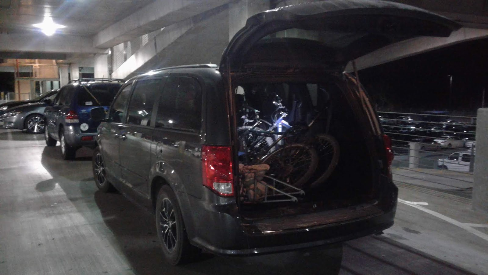
This marked our journey's end... for now!
Back to top
Gear List
What do you carry in there?
How much does all your stuff weigh?
So, how do you like those BOB’s?
Is there a baby in there?
How much does all your stuff weigh?
So, how do you like those BOB’s?
Is there a baby in there?

These, and more,
were the questions we heard over and over again on our Great Divide trip
regarding our gear. We traveled “old school,” each towing a Bob Yak Trailer. We really liked the flexibility of the trailers. We could haul as
much as we wanted—we were able to do the trip with a lot of the backpacking
gear we already owned—and when we wanted to travel light in a town or have a
“day trip” within our trip we could just drop the trailers and ride without the
weight.

We found that the
two biggest differences between us and the lightweight/in-line frame pannier
people (see the “Gear Planning” section of the Bikepacking Website for reference) were that (1) we carried
and cooked a lot more food, preferring to eat food that we liked and spend less
money versus picking up food at every gas station and restaurant along the way
and (2) we only had “pretty light weight” gear, not “ultra light weight”
gear—so we had a lot of the same kinds of things that everyone on the GDMBR carries
but not the lightest versions of those things.
 |
| Gear strewn about in front of our hostel as we prepared to start the trip |
So, what was in
those trailers (and panniers)?
Gear Item
|
Who Uses It
|
Notes
|
Camp
|
||
Big
Agnes two-person 15 degree sleeping bag
|
Shared
|
For the
time of year (end of July thorough early September) this was the right temp
bag for us. Some nights were too warm and some a bit chilly but it was
generally spot on.
|
Thermarest
prolight sleeping pads
|
Each
|
|
Big
Agnes 2 person tent
|
Shared
|
|
Alps 20
L sleeping bag stuff sack
|
Shared
|
|
Blue
foam sleeping pad cut into squares
|
Each
|
We cut
up an old foam sleeping pad so we’d each have a something to sit on. We kept
them on top of the Bobs while riding and they helped shed rain.
|
Water
|
||
Iodine
+ anti-iodine
|
Shared
|
Didn’t
use, back up water purification
|
4L
Platypus Water Filter
|
Shared
|
Jeff
let us borrow this and now we want to buy one for future use. It worked
great.
|
Squeeze
bottles for water plus extra water storage
|
Each
|
2
squeeze bottles each, plus various plastic juice containers as needed to add
extra water capacity
|
Toiletries
|
||
50 mL
bug spray
|
Each
|
30%
DEET. It worked like a charm.
|
30 spf
sunscreen
|
Shared
|
We went
through 3 or 4 bottles over 2 months
|
Butt
Butter
|
Jonathan
|
He
likes using this. We kept it in a 3 oz bottle and used a total of about 6 oz
over 2 months
|
Petroleum
Jelly
|
Shared
|
About a
3 oz bottle, used for chapped lips, feet, cuts and such
|
Mountain
Series “Weekender” medical first aid kit
|
Shared
|
Thankfully
we hardly used this but prefer to carry a FAK for emergencies.
|
Sam
Splint
|
Shared
|
The
“weekender” kit doesn’t come with a splint so we added this.
|
Plastic
Poop Trowel
|
Shared
|
For
pooping in the woods
|
Ziploc
bag full of Toilet Paper
|
Shared
|
For pooping
in the woods
|
Hand
sanitizer
|
Shared
|
For
pooping in the woods
|
Toothbrush
|
Shared
: )
|
We
meant to bring two, and then kept forgetting/didn’t want to add the weight.
|
Toothpaste
|
Shared
|
|
Floss
|
Shared
|
|
Plastic comb
|
Shared
|
|
Small shampoo bottle
|
Shared
|
|
Small camp soap bottle
|
Shared
|
|
Extra elastic hair tie
|
Katelyn
|
|
Natra-care compostable tampons
|
Katelyn
|
Started
with ½ and mailed the other half to myself for the second month.
|
Tide sink wash detergent packets
|
Shared
|
We did
laundry maybe every three weeks or so.
|
Ear plugs
|
Katelyn
|
Sometimes
I like having earplugs, like in hostels.
|
Small microfiber towel
|
Each
|
The
kind you might clean your car with. Came in handy.
|
Electronics
|
||
Solar
power back up charger
|
Shared
|
We liked
having this Waterproof Solar Charger on hand to charge lights and/or Jonathan’s
phone on long stretches away from electricity. It can either be charged by
the sun or (as we more commonly did—at an outlet).
|
Android
Smart Phone + charger
|
Jonathan
|
We
blogged, set up Warm Showers hosts, and occasionally used the phone as back
up navigation.
|
Samsung
Dumb Phone + charger
|
Katelyn
|
I also
carried my “dumb” phone. In retrospect I didn’t really need it but it was
nice texting friends occasionally.
|
Headlamp
+ 3 extra AAA batteries
|
Each
|
|
Bike headlights
and charger
|
Each,
shared charging cord
|
|
Bike
tail lights and charger
|
Each,
shared charging cord
|
|
Go pro,
helmet mount, charger
|
Jonathan
|
|
Cooking
|
||
Alcohol
stove
|
Shared
|
This
worked great. Here’s a DIY.
|
Heet (fuel
for stove)
|
Shared
|
Get the
YELLOW kind (not the red “ISO” heet, it behaves VERY differently with a much
larger flame and a lot f soot).
|
Aluminum
Foil wind screen
|
Shared
|
DIY. We
went through about 3 in two month.
|
Butterfly
paper clips
|
Shared
|
To clip
the wind screen together.
|
One
titanium and one durable plastic spoon
|
Shared
|
The
titanium spoon was better for cooking and scraping pans.
|
1.5 cup
plastic measuring/drink cup
|
Shared
|
|
Cigarette
Lighter
|
Shared
|
|
Backup
matches
|
Shared
|
|
Food
bag
|
Shared
|
|
Lunch knife
|
Shared
|
|
Chick fil a “plate”
|
Shared
|
The
plastic Chick-fil-a salad lid that served as or plate for our entire East
Coast trip also served u well on the GDMBR. So much for “disposable.”
|
Safety
|
||
Whistle/compass
combo
|
Shared
|
We
especially used this while on hiking excursions.
|
50 ft
rope + small plastic pulley for bear bagging
|
Shared
|
We used
a pretty small diameter rope but met a guy using something analogous to
fishing line for his bear bag rope. This is why our packs were larger…
|
Shared
|
Jeff
let us borrow this great product in case we got lost in the woods and needed
to call in emergency responders.
|
|
Bicycle
Helmets
|
Each
|
|
Clothes
|
||
Each
|
We
LOVED these. And the old ladies loved them too… We figured this was a long
term investment in our skin health and always having your own personal shade
tree sure is nice.
|
|
SPD cleat shoes
|
Each
|
Lots of
folks used hiking-type shoes on the GDBMR. In retrospect Jonathan was glad he
had his cleats and I would have used light hiking shoes.
|
Bike Shoe
Covers
|
Each
|
|
Teva
type shoes
|
Each
|
We both
had Teva-type shoes with good soles for camp and day hikes.
|
Handkerchief
|
Each
|
|
Seat
Cover
|
Jonathan
|
|
Helmet
cover
|
Jonathan
|
He used
it a couple times and was glad of it. My head just got wet…
|
Waterproof
warm gloves
|
Each
|
Worth
it in the rain and sometimes in the early morning.
|
Cotton
gloves
|
Jonathan
|
Mostly
wore these in camp.
|
Fingerless
bike gloves
|
Each
|
|
Warm
knit hats
|
Each
|
|
Baseball
cap
|
Katelyn
|
|
Brimmed
hat
|
Jonathan
|
|
2 pairs
bike shorts
|
Each
|
|
2
synthetic T shirts
|
Each
|
|
Comfortable
wool T shirt
|
Each
|
|
Zip off
bike leggings
|
Each
|
We wore
these a lot while riding,
|
2 pairs
bike socks
|
Each
|
|
1 pair Wool socks
|
Each
|
|
Sunglasses
|
Jonathan
|
|
Synthetic pants
|
Each
|
|
Rain jacket
|
Each
|
|
Warm jacket
|
Each
|
|
Reflective vests
|
Each
|
|
Clothes stuff sack
|
Each
|
|
Bike Tools
|
||
Dry lube and wet lube
|
Shared
|
We
didn’t ue the wet lube and in retrospect would have just brought dry lube.
|
Eno Hammock Tarp and tent steaks
|
Shared
|
This
was a fun luxury. We brought it as an emergency rain shelter but only used it
as a sun shelter.
|
Chick-fil-a Plush Cow
|
Shared
|
She’s
been with us for this whole journey.
|
Road Morgh G Air Pump
|
Shared
|
|
Clip on fenders
|
Each
|
|
Pliers
|
Shared
|
|
Toothbrush for cleaning bike drive train
|
Shared
|
|
Zip ties
|
Shared
|
|
Extra brake pad
|
Shared
|
Mine
was looking janky before we left home but made it through the entire trip.
|
Emergency tire boot
|
Shared
|
|
Extra spoke nipples
|
Shared
|
|
Chain quick links
|
Shared
|
|
Spoke Tool
|
Shared
|
|
Chain Breaker
|
Shared
|
|
Spin Doctor Allen keys
|
Shared
|
|
Spare Spokes
|
Shared
|
|
Slime Skab Inner Tube Patches
|
Shared
|
|
Bit of Old Inner Tube
|
Shared
|
|
Spare 26” Folding Tire
|
Shared
|
|
Spare 16” Bob Tire
|
Shared
|
|
Spare bob axel
|
Shared
|
|
Tire Levers
|
Shared
|
|
Spare Inner Tubes
|
Shared
|
|
Cable Lock
|
Each
|
|
Navigation
and Paperwork
|
||
“Wallet” plastic bag with credit card, ID,
insurance card, national park pass, cash, checkbook
|
Each
(but only one park pass and check book)
|
|
Adventure Cycling Association GDMBR maps
|
Shared
|
|
Book- Cycling the Great Divide: From Canada
to Mexico on America's Premier Long Distance Mountain Bike Route, by McCoy
|
Shared
|
We
really enjoyed all the great information in this guide.
|
Local road and bike maps
|
Shared
|
Picked
up along the way.
|
Small Notebook
|
Shared
|
|
Pen
|
Each
|
|
Handlebar mounted bell and vompass
|
Katelyn
|
|
Luggage
and Miscellaneous
|
||
Tyvek Ground Cloth
|
Jonathan
|
Used to
cover Jonathan’s Bob and keep the duffel bag waterproof.
|
Bungee Cords
|
Each
|
To hold
down the Bob bags.
|
Bob Trailer
|
Each
|
|
Bob Bag
|
Katelyn
|
I had
the fancy waterproof Bob-brand bag.
|
Duffel Bag
|
Jonathan
|
Jonathan
just used a large duffel.
|
REI Flashpack
Backpack
|
Shared
|
Very
handy for hikes and forays into town.
|
Jandd Large Mountain Panniers
|
Katelyn
|
|
Trekking Poles
|
Shared
|
Were
used to prop up our bikes and used on hikes.
|
Extra Ziploc bags
|
Shared
|
These
come in handy.
|
Fork Cage
|
Jonathan
|
For
holding cylindrical items like extra water or (now that we’re home) half
gallons of milk.
|
Back to top
Reading List
Required Reading:
This book presents a day-by-day itinerary of the whole route in 70 days, including information on where to find important resources along the way (like water) and notes on natural and historical contexts of the places through which the route passes.
Great Divide Mountain Bike Route folding map set by Adventure Cycling Association
These waterproof, tear-resistant maps include turn-by-turn directions along the entire route as well as mapped locations and contact information for services such as campgrounds, hotels, restaurants, post offices, and more.
Recommended Reading:
Discovering the Vernacular Landscape by John Brinckerhoff JacksonIn this small but beautifully written book, John Brinckerhoff Jackson outlines historical western understandings of and attitudes toward various elements of our landscape, which he defines as “A composition of man-made or man-modified spaces to serve as infrastructure or background for our collective existence.”
I read this book a few months prior to leaving for our bike
trip as part of the Atlanta City Studio monthly book club. This is one of the
most delightful books I have ever read on the subject of man-made spaces, and
it also helped to enrich the experience of traveling through so many of them on
our trip. Yes, we saw many “natural” spaces on the trip, too, but we never left
the man-made ones too far behind (think roads, trails, national parks, etc.). This
book also taught me one of my new favorite words, “odology,” which means the study of roads.
A few of the other interesting subjects covered in the book include:
 |
| How agricultural technology has shaped the American landscape |
 |
| Mobile homes and their uses and connotations in America |
(It was interesting noticing how much of the housing in many of the towns we passed through was comprised of mobile homes. This may have to do with the nature of many of the natural resource related jobs which can sometimes come and go quickly. On a similar vein, Discovering the Vernacular Landscape also includes an interesting historical perspective on Western preferences for brick and stone homes over wood from the Middle Ages to today.)
 |
| How western American towns developed differently from eastern ones |
Celebration of Discipline by Richard Foster
“Superficiality is the curse of our age. The doctrine of
instant satisfaction is a primary spiritual problem. The desperate need today
is not for a greater number of intelligent people, or gifted people, but for
deep people.”
This is how author Richard Foster opens his book Celebration of Discipline, first published in 1978. I was thankful to have read this book (which was our church-wide “summer reading book” for summer 2017) before going on our bike trip.
This is how author Richard Foster opens his book Celebration of Discipline, first published in 1978. I was thankful to have read this book (which was our church-wide “summer reading book” for summer 2017) before going on our bike trip.
The author tells us that the classical spiritual disciplines
help us orient our everyday lives in such a way as to call us beyond surface
living and help us to “explore the inner caverns of the spiritual realm.” The
classical spiritual disciplines the author refers to here are twelve spiritual
disciplines which he traces all the way back to the early church (and even
earlier) and which he spends the rest of the book discussing. These disciplines
are meditation, prayer, fasting, study, simplicity, solitude, submission,
service, confession, worship, guidance, and celebration. The first four he
categorizes as inward, the second four as outward, and the third for as
corporate.
To explain our need for The Spiritual Disciplines, the
author draws on an analogy from Isaiah 57:20, pointing out that, just as the
sea repeatedly churns up dirt and mire in its natural motions, so we, in our
natural state of sin and rebellion, tend to produce acts of selfishness and
wickedness without even trying to. If we want to deal with the problem of the
wicked and rebellious acts that we so easily produce, our response cannot
simply be an attempt to address the symptoms of our problem (i.e. our actions),
but we must instead invite God to work at the root of the problem, which begins
in our hearts. The spiritual disciplines help to put us in a place where we
acknowledge our own issues and invite God to work in us and transform us.
The author makes clear that we are not saved by spiritual
disciplines. In fact, when misunderstood and misapplied, they can become a form
of tyrannical legalism. On the other hand, they should not be discounted.
Righteousness is a gift of God's free grace and not something we ourselves can
accomplish. But this does not mean we should sit back and do nothing. Citing
Galatians 6:8, the author compares the spiritual disciplines to farming: “A
farmer is helpless to grow grain; all he can do is to provide the right
conditions for the growing of grain. He puts the seed in the ground where the
natural forces take over and up comes the grain. That is the way of the
Spiritual Disciplines—they are a way of sowing to the Spirit. The Disciplines
are God's way of getting us into the ground; they put us where he can work
within us and transform us.”


Reading this book helped me to understand both the power and
the place of the Classical spiritual disciplines in the Christian life, and spending
several weeks together traveling by bicycle afforded a refreshing time of
solitude and distance from our typical routines to focus on putting some of
these disciplines into practice.
This historical work by Stephen E. Ambrose tells the
chronological history of the Lewis and Clark expedition in great detail but in
a very readable fashion. I have been reading this long but fascinating book for
some time now and have still not quite finished it, but reading beforehand
about the Lewis and Clark expedition and the places they went, the Native
American tribes they met, and the other glimpses into the American landscape
prior to the westward expansion of the United States really helped enrich the
trip for me. It was especially interesting recognizing the names of various
landmarks, geographic features, and Native American tribes that were mentioned
by Lewis and Clark—as well as passing by the utmost source of the MissouriRiver on our trip.

 |
| Hell Roaring Creek, Centennial Valley, MT |
Written by John Bunyan in 1678, Pilgrim's Progress is
an allegorical work portraying the journey of the Christian life as a voyage down
a long, difficult road to a heavenly kingdom. The journey is ridden with
dangers and snares, but the traveler also finds rest and relief at just the
right times.
This is one of Katelyn’s and my favorite books, and it came
to mind frequently during our trip for various reasons, as mentioned in our
post from days 45-47.Bible
The story of who God is, who we are, and how God reconciles himself with us and all creation. During our trip, we were reading and meditating on the theme of wilderness in the Bible. You can read more on that in our post from days 41-44.
Back to top